- My Forums
- Tiger Rant
- LSU Recruiting
- SEC Rant
- Saints Talk
- Pelicans Talk
- More Sports Board
- Fantasy Sports
- Golf Board
- Soccer Board
- O-T Lounge
- Tech Board
- Home/Garden Board
- Outdoor Board
- Health/Fitness Board
- Movie/TV Board
- Book Board
- Music Board
- Political Talk
- Money Talk
- Fark Board
- Gaming Board
- Travel Board
- Food/Drink Board
- Ticket Exchange
- TD Help Board
Customize My Forums- View All Forums
- Show Left Links
- Topic Sort Options
- Trending Topics
- Recent Topics
- Active Topics
Started By
Message
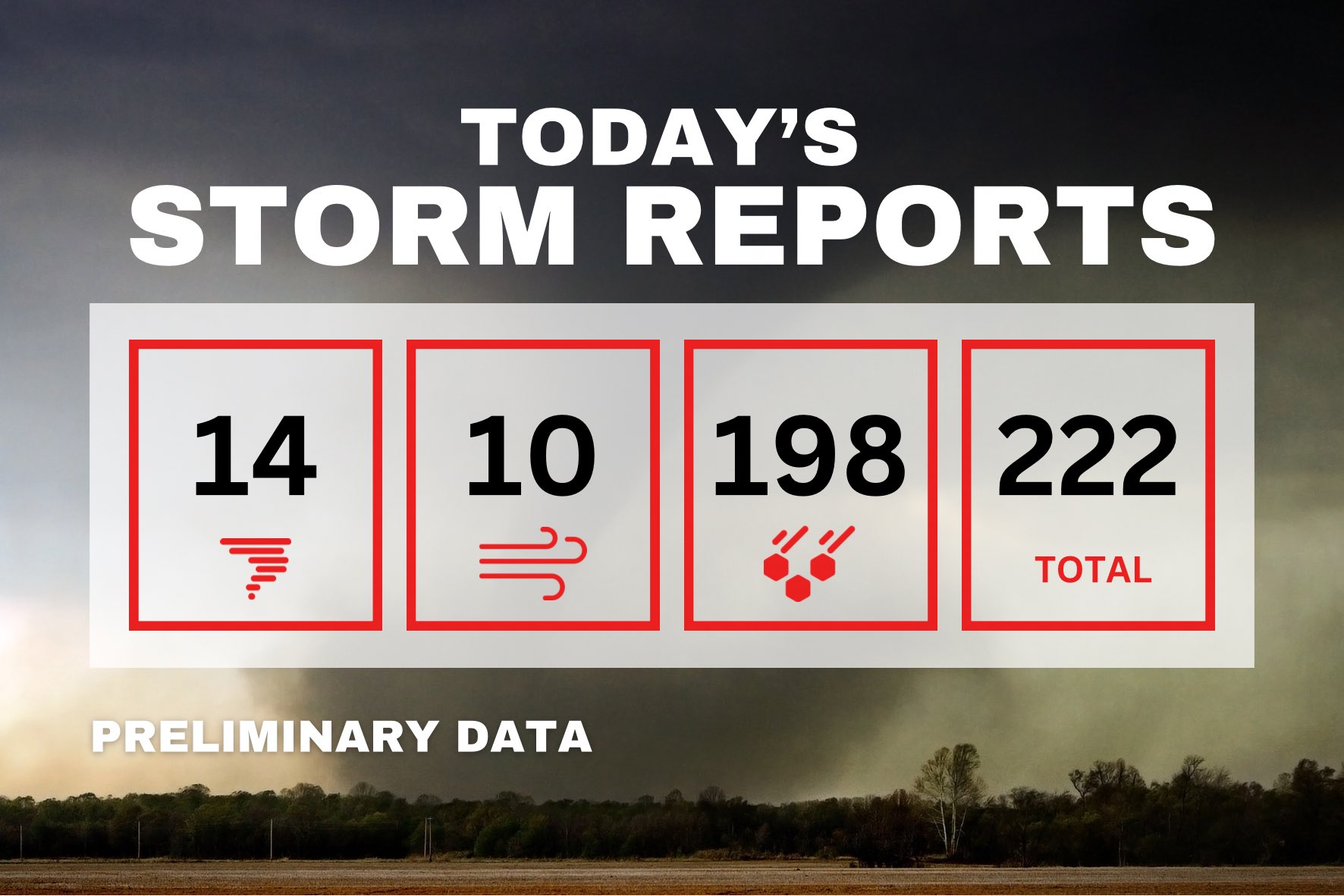
re: Severe Weather 4/19 Thread | Multiple Tornadoes in Midwest | At least 2 fatalities
Posted on 4/19/23 at 10:01 pm to TigerinOkieHell
Posted on 4/19/23 at 10:01 pm to TigerinOkieHell
quote:
Fair enough. I was thinking around 2pm if we got lucky we may see one or two cells. Never would have anticipated what we got tonight.
This reminds me of a similar setup and storm from last year (I think) in the same general area. I'd have to go digging to find it.
 2
2

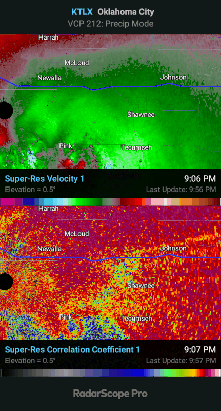

Posted on 4/19/23 at 10:02 pm to OU Guy
Another sharp northward turn as the circulation gets wrapped back up into the cell. We’ll see if it occludes.

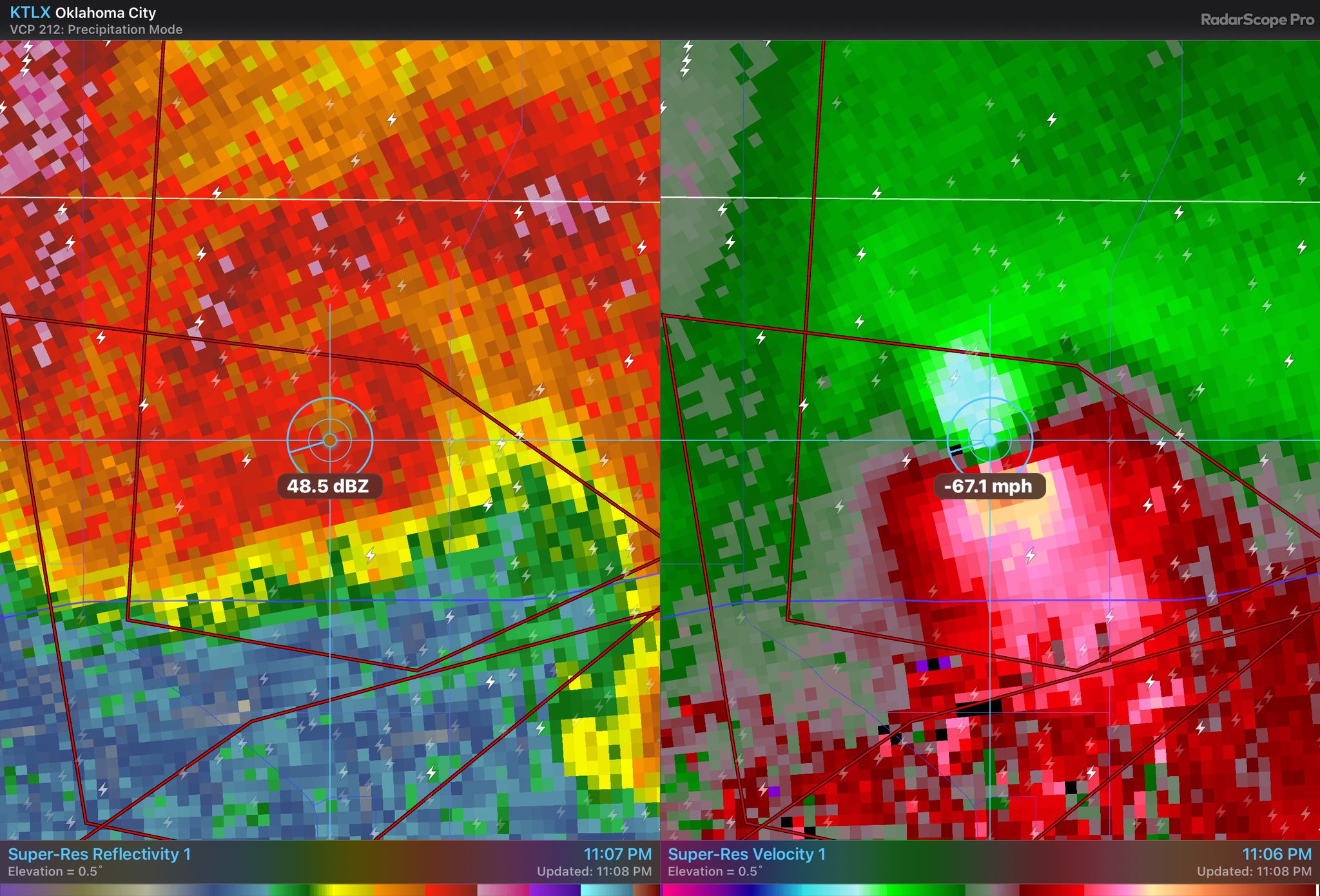
Posted on 4/19/23 at 10:03 pm to Roll Tide Ravens
Damn fine polygon placement, too.

Posted on 4/19/23 at 10:03 pm to LegendInMyMind
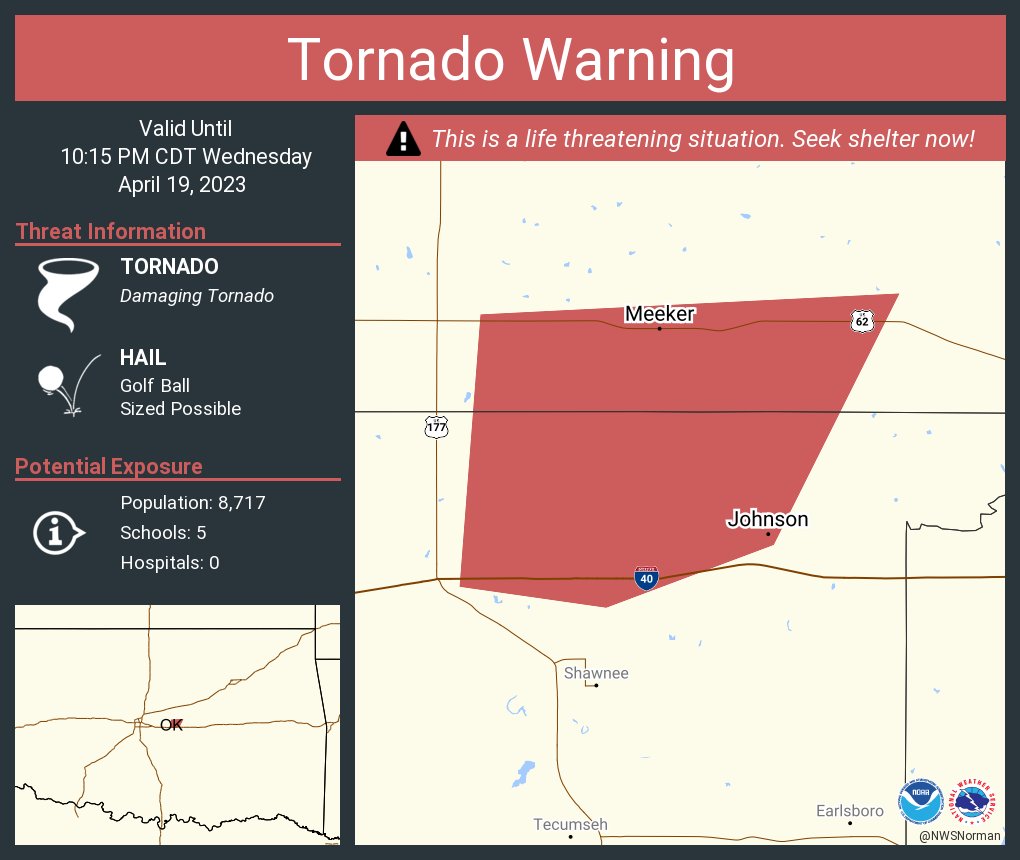
Posted on 4/19/23 at 10:03 pm to LegendInMyMind
Chimera Comstock
@SvrWxChaser
Just had a very close brush with the tornado currently hitting #shawnee, #Oklahoma. Lots of damage near the airport and fair grounds. Smell of gas in the air. #okwx
Image
10:01 PM · Apr 19, 2023
from Shawnee, OK·
Posted on 4/19/23 at 10:08 pm to OU Guy
NWS Norman
@NWSNorman
10:04pm - A DANGEROUS TORNADO CONTINUES NORTH OF SHAWNEE!
DUE TO THE ERRATIC MOTION OF THE STORM, DO NOT ANTICIPATE THE TORNADO MOTION.
IF YOU ARE IN THE POLYGON, TAKE SHELTER IMMEDIATELY!
@NWSNorman
10:04pm - A DANGEROUS TORNADO CONTINUES NORTH OF SHAWNEE!
DUE TO THE ERRATIC MOTION OF THE STORM, DO NOT ANTICIPATE THE TORNADO MOTION.
IF YOU ARE IN THE POLYGON, TAKE SHELTER IMMEDIATELY!
Posted on 4/19/23 at 10:08 pm to OU Guy
It is about to do the same thing all iver again. Another meso is forming to the east of the current tornado.
This post was edited on 4/19/23 at 10:17 pm
Posted on 4/19/23 at 10:13 pm to LegendInMyMind
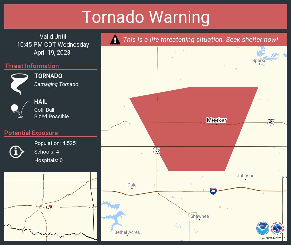
Posted on 4/19/23 at 10:13 pm to OU Guy
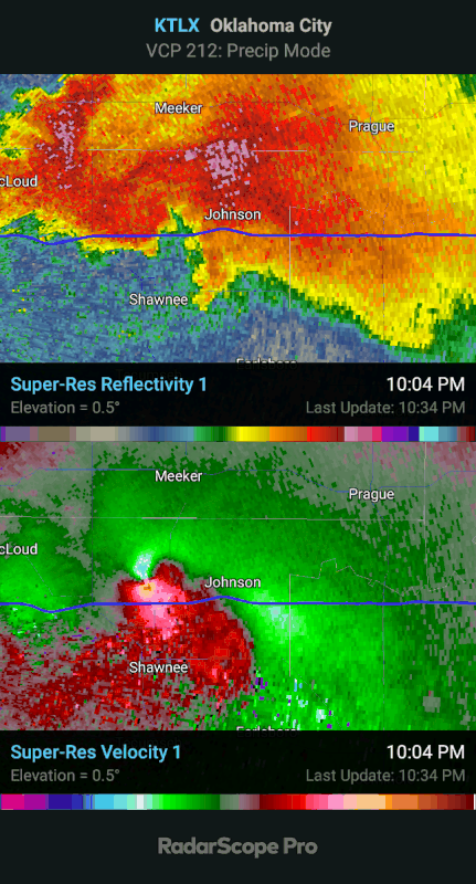
Meeker is next, population 1,200
A LARGE AND DANGEROUS TORNADO CONTINUES TO LIFE THREATENING DAMAGE HEADING FOR MEEKER AREA! GTG SHEAR ~180mph! SEEK TORNADO SAFE PLACE IMMEDIATELY!
A LARGE AND DANGEROUS TORNADO CONTINUES TO LIFE THREATENING DAMAGE HEADING FOR MEEKER AREA! GTG SHEAR ~180mph! SEEK TORNADO SAFE PLACE IMMEDIATELY!
Posted on 4/19/23 at 10:16 pm to LegendInMyMind
quote:
This reminds me of a similar setup and storm from last year (I think) in the same general area. I'd have to go digging to find it.
Just goes to show you gotta respect even the slight conditional risk days. Sure 9 out of 10 days nothing but just takes that one day.
Posted on 4/19/23 at 10:16 pm to LegendInMyMind
Oof
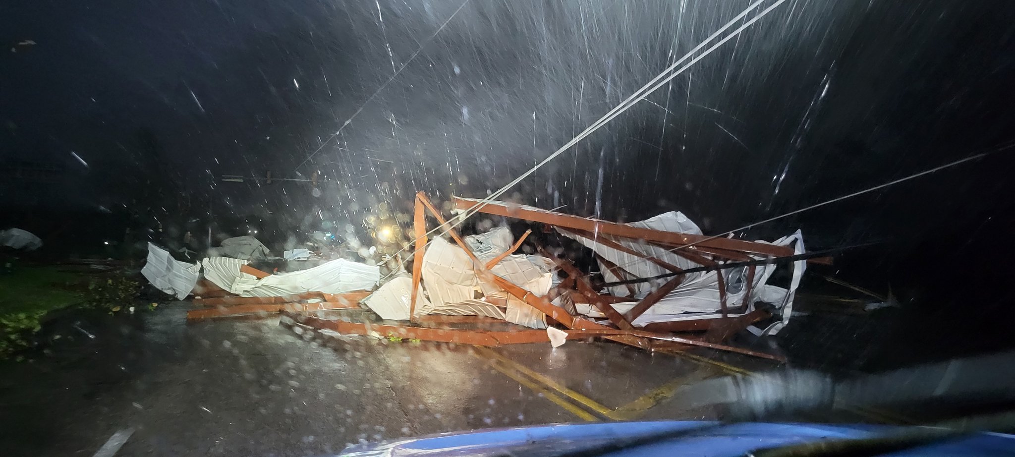
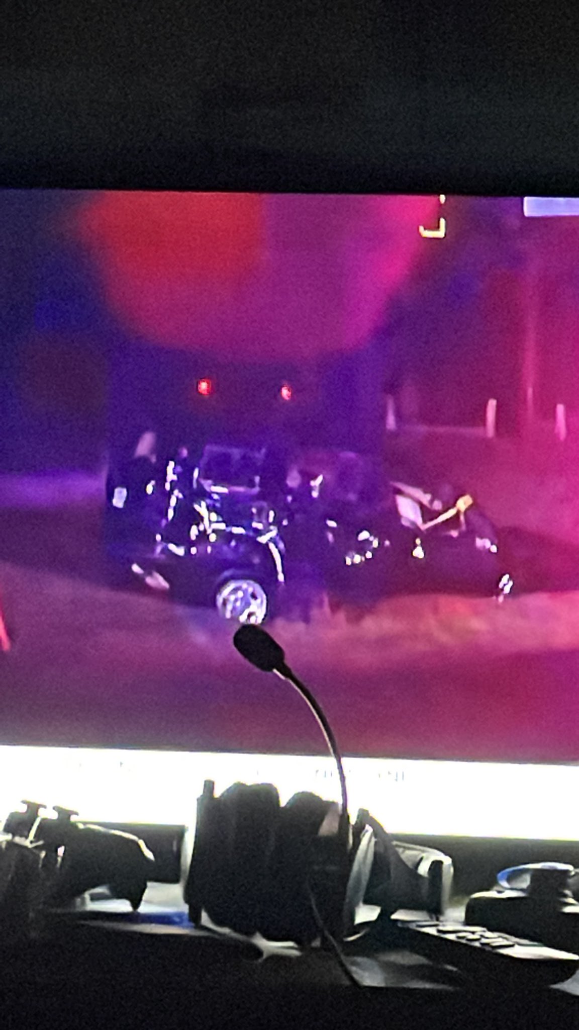
Posted on 4/19/23 at 10:17 pm to OU Guy
A very damaged car hit from the Shawnee Tornado In Oklahoma (Credit to news 9 Oklahoma)
Posted on 4/19/23 at 10:22 pm to Wishnitwas1998
Looks like the circulation approaching Meeker has occluded. Now the one further east is the main one.
Posted on 4/19/23 at 10:22 pm to OU Guy
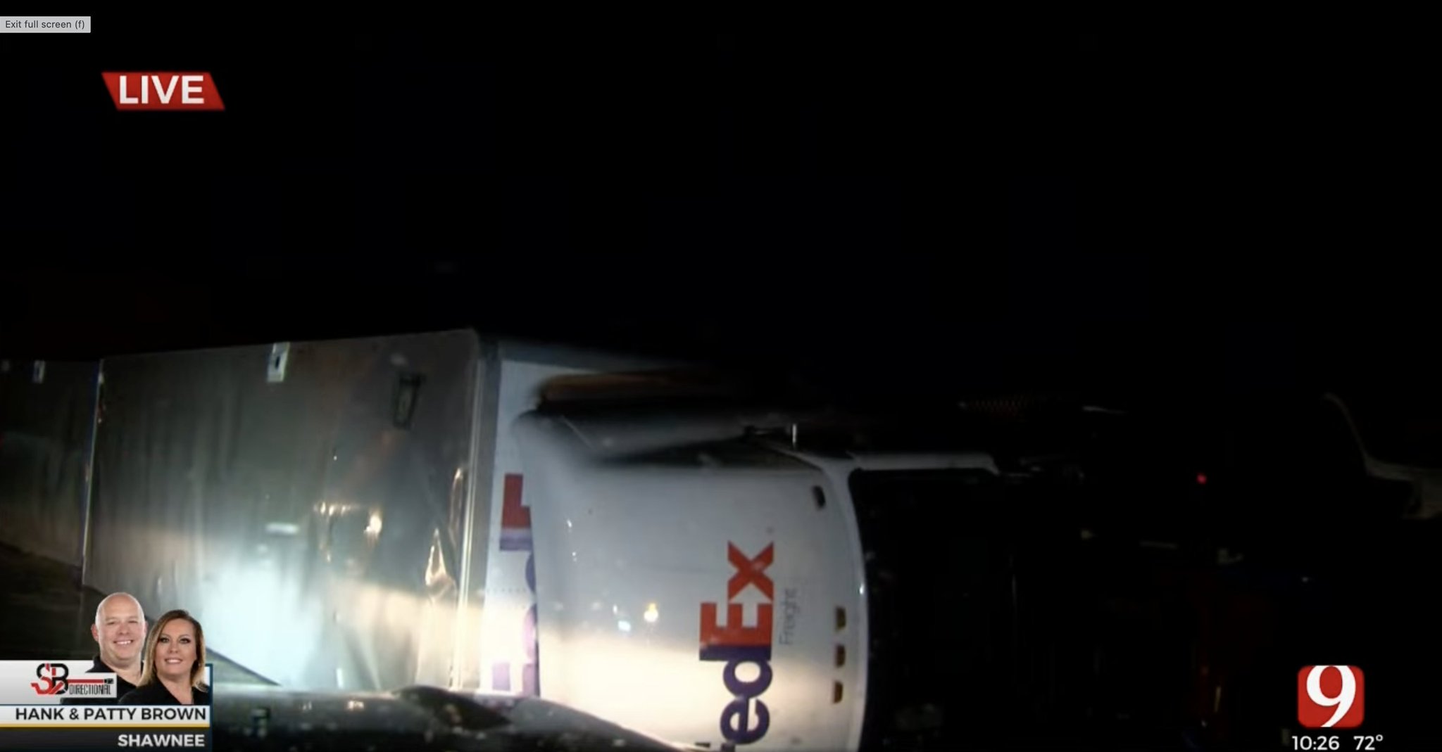
Posted on 4/19/23 at 10:29 pm to OU Guy
I-40 Shawnee area
Posted on 4/19/23 at 10:38 pm to LegendInMyMind
For whatever reason they dropped the warnings on it and they’re going to have to put one back up based on the last two frames.
Posted on 4/19/23 at 10:38 pm to slackster
And there it is.
Posted on 4/19/23 at 10:48 pm to slackster
* so far

 Page 8 of 11

Popular
Back to top