- My Forums
- Tiger Rant
- LSU Recruiting
- SEC Rant
- Saints Talk
- Pelicans Talk
- More Sports Board
- Winter Olympics
- Fantasy Sports
- Golf Board
- Soccer Board
- O-T Lounge
- Tech Board
- Home/Garden Board
- Outdoor Board
- Health/Fitness Board
- Movie/TV Board
- Book Board
- Music Board
- Political Talk
- Money Talk
- Fark Board
- Gaming Board
- Travel Board
- Food/Drink Board
- Ticket Exchange
- TD Help Board
Customize My Forums- View All Forums
- Show Left Links
- Topic Sort Options
- Trending Topics
- Recent Topics
- Active Topics
Started By
Message
re: Sunday Weather Thread
Posted on 5/2/21 at 7:43 pm to Roll Tide Ravens
Posted on 5/2/21 at 7:43 pm to Roll Tide Ravens
quote:
There are numerous storms with at least some rotation across central MS.
Every storm that has popped has started rotating almost immediately. Low CAPE, but good SRH, and Shear.
This post was edited on 5/2/21 at 7:44 pm
 1
1


Posted on 5/2/21 at 7:45 pm to LegendInMyMind

Posted on 5/2/21 at 7:45 pm to Bobby OG Johnson
Canton storm finally got warned.
Posted on 5/2/21 at 7:47 pm to Bobby OG Johnson
I'm liking the woman in the Jackson weather office at the link you posted. I didn't get a screen grab.
Posted on 5/2/21 at 7:48 pm to LegendInMyMind


Posted on 5/2/21 at 7:50 pm to Roll Tide Ravens
Confirmed tornado near Cameron, MS. This is the storm north of Jackson.
Posted on 5/2/21 at 7:51 pm to LegendInMyMind

Posted on 5/2/21 at 7:51 pm to Bobby OG Johnson

Posted on 5/2/21 at 7:51 pm to Roll Tide Ravens
Now that furthest north storm in MS has moved into NWS Memphis territory where every tornado warned storm is “producing” a tornado, whether it’s confirmed or not.
Posted on 5/2/21 at 7:52 pm to Bobby OG Johnson
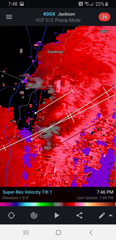
Odd structure on the storm near Pickens. Secondary rotation formed on Southern end with the appendage visible on Reflectivity. Doesn't look like it is anti-cyclonic on Velocity, but it may be.

Posted on 5/2/21 at 7:53 pm to Bobby OG Johnson
I know someone who knows that girl. I don’t know anything about her, though.
Posted on 5/2/21 at 7:53 pm to Roll Tide Ravens


Posted on 5/2/21 at 7:54 pm to tgrbaitn08
quote:
Nola about to get slammed
wat
Posted on 5/2/21 at 7:55 pm to Bobby OG Johnson

Posted on 5/2/21 at 7:58 pm to Bobby OG Johnson
Reed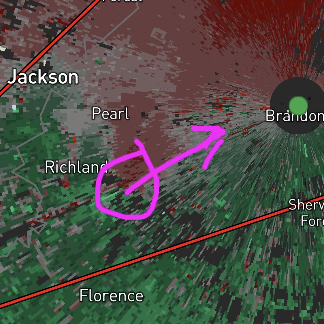
quote:
NEW circulation ramping up and approaching I20 near or just west of Brandon MS! Likely #tornado about to happen if not already with new circulation
Posted on 5/2/21 at 8:00 pm to Bobby OG Johnson

Posted on 5/2/21 at 8:06 pm to Bobby OG Johnson
There is a wall cloud and lowering with that storm per the on-air met. It is going to go pretty much directly over the radar.
This post was edited on 5/2/21 at 8:07 pm
Posted on 5/2/21 at 8:08 pm to LegendInMyMind
Watching it now 
Posted on 5/2/21 at 8:09 pm to Bobby OG Johnson
That's probably a tornado still on the ground near Slate Springs. Looks good on Velocity. Has a bit of a TDS.
This post was edited on 5/2/21 at 8:15 pm
Posted on 5/2/21 at 8:10 pm to Bobby OG Johnson
(no message)
This post was edited on 5/3/21 at 7:56 pm

 Page 7 of 14

Popular
Back to top