- My Forums
- Tiger Rant
- LSU Recruiting
- SEC Rant
- Saints Talk
- Pelicans Talk
- More Sports Board
- Fantasy Sports
- Golf Board
- Soccer Board
- O-T Lounge
- Tech Board
- Home/Garden Board
- Outdoor Board
- Health/Fitness Board
- Movie/TV Board
- Book Board
- Music Board
- Political Talk
- Money Talk
- Fark Board
- Gaming Board
- Travel Board
- Food/Drink Board
- Ticket Exchange
- TD Help Board
Customize My Forums- View All Forums
- Show Left Links
- Topic Sort Options
- Trending Topics
- Recent Topics
- Active Topics
Started By
Message
 4
4

Posted on 8/23/16 at 2:15 pm to LSU2001
quote:
Parts of that model sure look a lot like a 2005 storm that shall not be named
Hurricane Voldemort
This post was edited on 8/23/16 at 2:16 pm

Posted on 8/23/16 at 2:19 pm to LSU2001
quote:
Parts of that model sure look a lot like a 2005 storm that shall not be named
Oh, you mean the most intense storm ever measured in the Gulf of Mexico that devastated a large portion of Louisiana? Hurricane Rita.
Posted on 8/23/16 at 2:35 pm to LSU2001
quote:
Parts of that model sure look a lot like a 2005 storm that shall not be named
Hopefully it doesn't resemble something like Andrew. Granted, Andrew was a beast going into Florida in the first place, but it went through Andrew and emerged in the GOM very near where the current Euro model is forecasting.
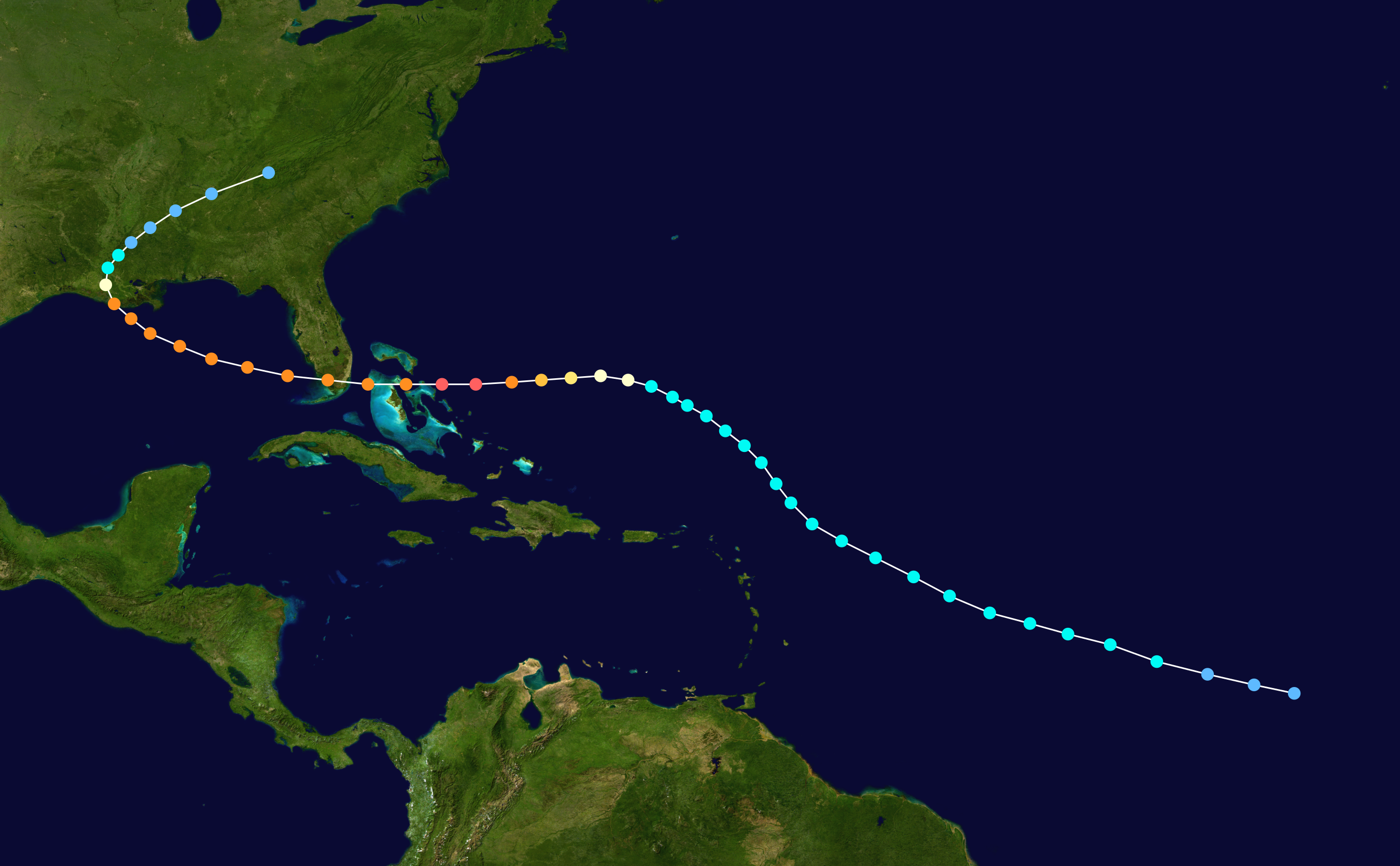
This post was edited on 8/23/16 at 2:36 pm

Posted on 8/23/16 at 2:48 pm to LSU2001
quote:
that shall not be named
I don't understand this at all. It was named Katrina. Katrina was its classified name. Why are you afraid to say or type Katrina?

 Page 1 of 1


Popular
Back to top