- My Forums
- Tiger Rant
- LSU Recruiting
- SEC Rant
- Saints Talk
- Pelicans Talk
- More Sports Board
- Fantasy Sports
- Golf Board
- Soccer Board
- O-T Lounge
- Tech Board
- Home/Garden Board
- Outdoor Board
- Health/Fitness Board
- Movie/TV Board
- Book Board
- Music Board
- Political Talk
- Money Talk
- Fark Board
- Gaming Board
- Travel Board
- Food/Drink Board
- Ticket Exchange
- TD Help Board
Customize My Forums- View All Forums
- Show Left Links
- Topic Sort Options
- Trending Topics
- Recent Topics
- Active Topics
Started By
Message
re: Major Louisiana Flood Event
Posted on 3/9/16 at 9:49 am to rds dc

Posted on 3/9/16 at 9:49 am to rds dc
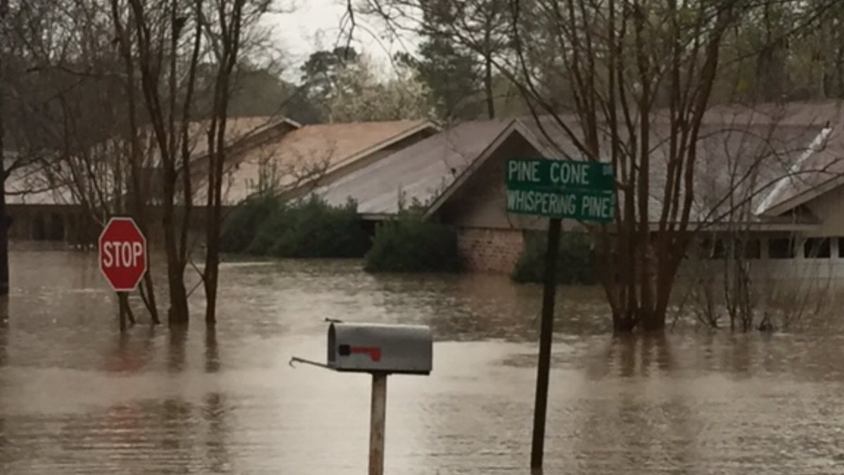
How the frick does the NWS miss this forecast by 200 miles? All this rain we were supposed to get in LC ended up in Shreveport. I could understand if it were an hour away or whatnot, but 200 miles?
This is one of NWS's all time busts events here. Thays an understatement.
This is one of NWS's all time busts events here. Thays an understatement.
 5
5


Posted on 3/9/16 at 9:50 am to Prominentwon
Posted on 3/9/16 at 9:53 am to Prominentwon
You sure you want to jinx yourself like that. This thing isn't over.
Posted on 3/9/16 at 10:14 am to Prominentwon
quote:
How the frick does the NWS miss this forecast by 200 miles? All this rain we were supposed to get in LC ended up in Shreveport. I could understand if it were an hour away or whatnot, but 200 miles?
This is one of NWS's all time busts events here. Thays an understatement.
This has been a very hard system to forecast. The models have really struggled with it and there aren't many analogs for such a highly unusual setup.
Deep tropical moisture is streaming north out of the Gulf resulting in record PWAT across Texas, Louisiana and Arkansas. So one of the main ingredients is in place for extreme rainfall but the triggers have been very hard to get a handle on. Numerous waves of energy have been rotating around the base of the system and kicking out across Texas. Each of these waves of energy sets off rounds of thunderstorms. Forecasting convective evolution is still extremely hard and that is making it hard to nail down who gets the most rain and when.
Trends this morning certainly point to SE Texas and SW Louisiana getting in on the action today.
Posted on 3/9/16 at 10:14 am to Prominentwon
You sure about the LC forecast? All the models I saw had the bullseye North of LC, south of S'port. Right over Toledo Bend.
Posted on 3/9/16 at 11:17 am to Prominentwon
quote:
How the frick does the NWS miss this forecast by 200 miles?
because the ULL is in Mexico and their met services aren't very modern - according to Dr. Masters on WU

 Page 1 of 1


Popular
Back to top