- My Forums
- Tiger Rant
- LSU Recruiting
- SEC Rant
- Saints Talk
- Pelicans Talk
- More Sports Board
- Fantasy Sports
- Golf Board
- Soccer Board
- O-T Lounge
- Tech Board
- Home/Garden Board
- Outdoor Board
- Health/Fitness Board
- Movie/TV Board
- Book Board
- Music Board
- Political Talk
- Money Talk
- Fark Board
- Gaming Board
- Travel Board
- Food/Drink Board
- Ticket Exchange
- TD Help Board
Customize My Forums- View All Forums
- Show Left Links
- Topic Sort Options
- Trending Topics
- Recent Topics
- Active Topics
Started By
Message
re: Southeastern Severe Weather Thread: 12/9-12/10
Posted on 12/9/23 at 2:49 pm to TXLSUCHE
Posted on 12/9/23 at 2:49 pm to TXLSUCHE
Tricky things going on with the winds aloft in the general area of the new Enhanced risk. Looks to be a bit of a shortwave at 700mb and the direction of flow around the surface low has sifted over the past couple hours. Instead of being oriented in such a way that forcing would be really strong (causing a quick line out into a QLCS) it is more perpendicular to the front causing this broken line look to persist.
This is a similar scenario I'm a little concerned about for North AL later, but with a brief window for the LLJ to cause a similar look prior to forcing a line.
This is a similar scenario I'm a little concerned about for North AL later, but with a brief window for the LLJ to cause a similar look prior to forcing a line.
 1
1

Posted on 12/9/23 at 2:50 pm to LegendInMyMind
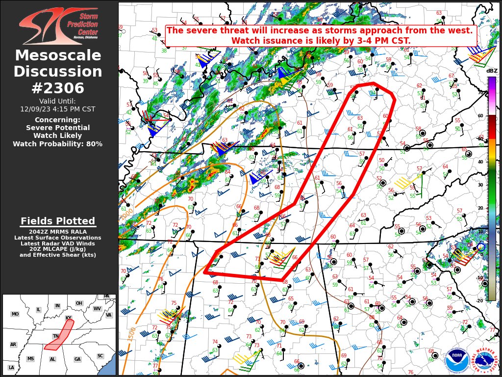
And the SPC is seeing that, too, with their latest update:

 Page 1 of 1


Popular
Back to top