- My Forums
- Tiger Rant
- LSU Recruiting
- SEC Rant
- Saints Talk
- Pelicans Talk
- More Sports Board
- Fantasy Sports
- Golf Board
- Soccer Board
- O-T Lounge
- Tech Board
- Home/Garden Board
- Outdoor Board
- Health/Fitness Board
- Movie/TV Board
- Book Board
- Music Board
- Political Talk
- Money Talk
- Fark Board
- Gaming Board
- Travel Board
- Food/Drink Board
- Ticket Exchange
- TD Help Board
Customize My Forums- View All Forums
- Show Left Links
- Topic Sort Options
- Trending Topics
- Recent Topics
- Active Topics
Started By
Message
re: (VID) Nicaragua water passage system once allowed Pacific access to America (1600s)
Posted on 12/28/22 at 2:08 pm to fightin tigers
Posted on 12/28/22 at 2:08 pm to fightin tigers
quote:
Isn't there a "mountain range" through that area? Would the river have gone up and over the mountains?
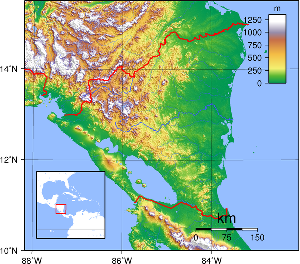
Lake Nicaragua sits in a Rift Valley, meaning a navigable waterway to/from it could exist between higher mountain passes without necessitating that travelers go over the mountains. The lake only sits at 108’ above sea level but is situated in such a way that it could theoretically discharge to both coasts if the routes to sea were unimpeded
This post was edited on 12/28/22 at 2:09 pm
 1
1

Posted on 12/28/22 at 3:31 pm to MrWalkingMan
quote:
Lake Nicaragua sits in a Rift Valley, meaning a navigable waterway to/from it could exist between higher mountain passes without necessitating that travelers go over the mountains.
The lake only sits at 108’ above sea level but is situated in such a way that it could theoretically discharge to both coasts if the routes to sea were unimpeded
Given that topographical information (108' elevation) and map, you wonder if its possible for engineers to just trench out rivers that have shifted to flow just below ground? (or diverted into a shallow aquifer?)
You would also think Lidar might be able to sort that whole possibility out -- including depth of the possible "shadow rivers."

 Page 1 of 1


Popular
Back to top