- My Forums
- Tiger Rant
- LSU Recruiting
- SEC Rant
- Saints Talk
- Pelicans Talk
- More Sports Board
- Fantasy Sports
- Golf Board
- Soccer Board
- O-T Lounge
- Tech Board
- Home/Garden Board
- Outdoor Board
- Health/Fitness Board
- Movie/TV Board
- Book Board
- Music Board
- Political Talk
- Money Talk
- Fark Board
- Gaming Board
- Travel Board
- Food/Drink Board
- Ticket Exchange
- TD Help Board
Customize My Forums- View All Forums
- Show Left Links
- Topic Sort Options
- Trending Topics
- Recent Topics
- Active Topics
Started By
Message
re: Ian Observation Thread (Storm Track and Radar inside)
Posted on 9/27/22 at 5:31 am to Klondikekajun

Posted on 9/27/22 at 5:31 am to Klondikekajun
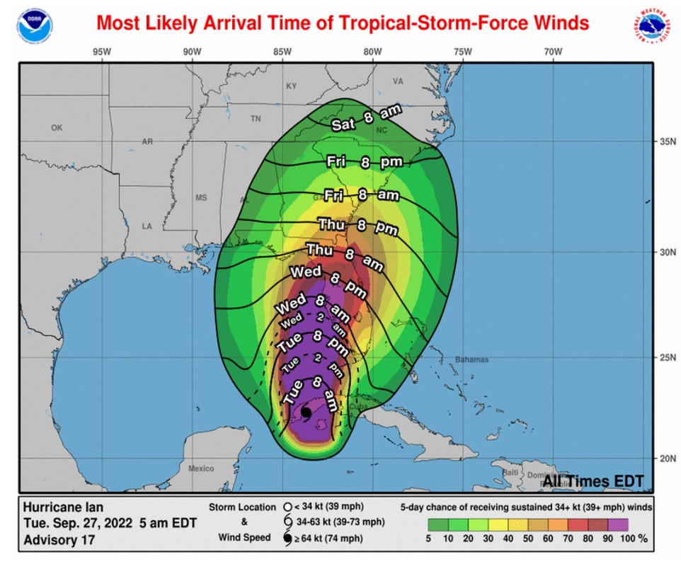
Looks like we’ve got good agreement now between the models that we’ll see an actual landfall rather than Ian clinging to the coast. NHC come reflects that, of course. Gonna be a wild ride for many in Florida.
 3
3

Posted on 9/27/22 at 5:32 am to Roll Tide Ravens

Posted on 9/27/22 at 5:37 am to Roll Tide Ravens
Traffic is building on I-4, approaching Disney, and on the turnpike, by Clermont, both approaching Orlando.

Posted on 9/27/22 at 6:01 am to Roll Tide Ravens
quote:
...we’ll see an actual landfall rather than Ian clinging to the coast. NHC come reflects that, of course. Gonna be a wild ride for many in Florida.
Seems devastating coastal impacts to western FL are inevitable.
But it shouldn't be overlooked that the latest forecasts show movement inland across central FL. While the storm will be weakening, all FL residents (except western panhandle) should prepare for tropical storm force winds, flooding rain and widespread power outages.
This post was edited on 9/27/22 at 6:06 am

 Page 1 of 1


Popular
Back to top