- My Forums
- Tiger Rant
- LSU Recruiting
- SEC Rant
- Saints Talk
- Pelicans Talk
- More Sports Board
- Fantasy Sports
- Golf Board
- Soccer Board
- O-T Lounge
- Tech Board
- Home/Garden Board
- Outdoor Board
- Health/Fitness Board
- Movie/TV Board
- Book Board
- Music Board
- Political Talk
- Money Talk
- Fark Board
- Gaming Board
- Travel Board
- Food/Drink Board
- Ticket Exchange
- TD Help Board
Customize My Forums- View All Forums
- Show Left Links
- Topic Sort Options
- Trending Topics
- Recent Topics
- Active Topics
Started By
Message

The Wall - US - Mexico Interactive Border Map
Posted on 1/11/18 at 12:34 am

Posted on 1/11/18 at 12:34 am
USA Today link
This is a pretty interesting map of the current barrier system in place along the US-Mexico border.
Vehicle fence is in yellow.
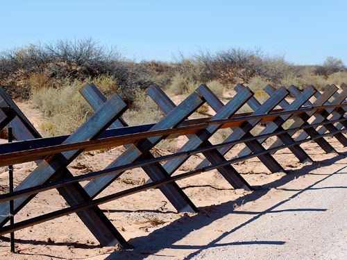
Pedestrian fence is in red.

Other type of fence is in green.
As you can see from the map in the link, probably only 30% of the border from San Diego to El Paso has a pedestrian barrier, the rest is vehicle barrier, roughly 10% of the border from El Paso to Brownsville has a pedestrian barrier, most of the TX border has zero barrier. (this is where most of my family and friends cross)
On the map you can click on any stretch and see live helicopter footage of that area showing a birds eye view of the border.
I think installing a pedestrian barrier covering 90% of the border (minus the native lands in part of AZ SW of Tucson) from San Diego to El Paso could be a worthy investment . It would reduce human and drug smuggling in those regions specifically and bring the total numbers down because not all of them would make the effort to travel to S TX to cross.
As for a physical barrier along the Rio Grande I do not see that happening. Too many variables at play. Some combination of increased man power and technology, along with stricter immigration laws to discourage people from crossing are probably the best bet.
Setting politics of it aside, the USA interactive map was pretty coo so figured I'd start this thread.
This is a pretty interesting map of the current barrier system in place along the US-Mexico border.
Vehicle fence is in yellow.
Pedestrian fence is in red.
Other type of fence is in green.
As you can see from the map in the link, probably only 30% of the border from San Diego to El Paso has a pedestrian barrier, the rest is vehicle barrier, roughly 10% of the border from El Paso to Brownsville has a pedestrian barrier, most of the TX border has zero barrier. (this is where most of my family and friends cross)
On the map you can click on any stretch and see live helicopter footage of that area showing a birds eye view of the border.
I think installing a pedestrian barrier covering 90% of the border (minus the native lands in part of AZ SW of Tucson) from San Diego to El Paso could be a worthy investment . It would reduce human and drug smuggling in those regions specifically and bring the total numbers down because not all of them would make the effort to travel to S TX to cross.
As for a physical barrier along the Rio Grande I do not see that happening. Too many variables at play. Some combination of increased man power and technology, along with stricter immigration laws to discourage people from crossing are probably the best bet.
Setting politics of it aside, the USA interactive map was pretty coo so figured I'd start this thread.
This post was edited on 1/11/18 at 12:35 am
 3
3

Posted on 1/11/18 at 7:04 am to IllegalPete
Why not along the "native lands"? Are they supposed to build their own?
Posted on 1/11/18 at 7:05 am to IllegalPete
Needs a mine field

Posted on 1/11/18 at 7:07 am to IllegalPete
This is actually very cool.
Posted on 1/11/18 at 8:45 am to GetCocky11
Cooler than I thought it was going to be

 Page 1 of 1


Popular
Back to top