- My Forums
- Tiger Rant
- LSU Recruiting
- SEC Rant
- Saints Talk
- Pelicans Talk
- More Sports Board
- Fantasy Sports
- Golf Board
- Soccer Board
- O-T Lounge
- Tech Board
- Home/Garden Board
- Outdoor Board
- Health/Fitness Board
- Movie/TV Board
- Book Board
- Music Board
- Political Talk
- Money Talk
- Fark Board
- Gaming Board
- Travel Board
- Food/Drink Board
- Ticket Exchange
- TD Help Board
Customize My Forums- View All Forums
- Show Left Links
- Topic Sort Options
- Trending Topics
- Recent Topics
- Active Topics
Started By
Message
re: Storm Tracking Thread: Post Tropical Storm Hermine
Posted on 8/27/16 at 2:02 pm to deuce985
Posted on 8/27/16 at 2:02 pm to deuce985
The fact that this "system" has hung around for so long makes me a bit nervous, especially when it gets into the Gulf. The fact that we're seeing more consensus now regarding strengthening as it heads into the Gulf is a little concerning.
 0
0

Posted on 8/27/16 at 2:03 pm to RazorBroncs
depends on how strong that high pressure ridge is that miraculously drops straight down from north to south and blocks the storm
Posted on 8/27/16 at 2:04 pm to Costanza
quote:I don't know the category storm it would be but that converts to 28.44 inches of mercury barometric pressure.
If it gets to 963mb as that model suggests, what category storm is that typically?
Posted on 8/27/16 at 2:04 pm to SlapahoeTribe
quote:
; I've weathered a Cat 4/5 like a spring rain
That would be?

Posted on 8/27/16 at 2:05 pm to Roll Tide Ravens
I'm interested to see if the Euro ensembles actually go along with what the operational run shows.
Posted on 8/27/16 at 2:10 pm to LSURussian
(no message)
Posted on 8/27/16 at 2:10 pm to LSU1NSEC
Seems like it has been predicting that consistently. Has it even shown signs that's happening the past few days? Something tells me Euro is very wrong.
Posted on 8/27/16 at 2:12 pm to LSURussian
quote:
If it gets to 963mb
In the tropical Atlantic Basin 963 is usually a Cat 2 but can vary with size of the storm. Isaac was in the upper 960s if I recall correctly.
Posted on 8/27/16 at 2:12 pm to LSURussian
Lili was 963mb at landfall (table 1). Reports says it landed as a cat 1.
That can't be right??? Chart shows mb at landfall; top part says landed at cat 1
That can't be right??? Chart shows mb at landfall; top part says landed at cat 1
This post was edited on 8/27/16 at 2:15 pm
Posted on 8/27/16 at 2:13 pm to LSURussian
Getting into Cat 3 neighborhood, but likely a 2.
IIRC, Rita got sub 900 mb for a bit roaring across the gulf.
IIRC, Rita got sub 900 mb for a bit roaring across the gulf.
This post was edited on 8/27/16 at 2:13 pm
Posted on 8/27/16 at 2:19 pm to tiger91
Well Florida has nothing to worry about.

Posted on 8/27/16 at 2:19 pm to Duke
quote:
IIRC, Rita got sub 900 mb for a bit roaring across the gulf.
Yeah. 4th most intense storm, by pressure, in the Atlantic Basin. Rita was a REAL bad bitch for a while there. I've seen what she did to Cameron Parish after she weakened. I can't imagine what she'd have done if she'd hit at her peak.
This post was edited on 8/27/16 at 2:21 pm
Posted on 8/27/16 at 2:21 pm to NorthEndZone
Latest models in case anyone hasn't seen them lately...clear as mud 

This post was edited on 8/27/16 at 2:23 pm
Posted on 8/27/16 at 2:21 pm to TigerstuckinMS
I thank God it weakened. Screwed our area up BADLY. Would have hated to see worse.

Posted on 8/27/16 at 2:22 pm to deuce985
Here's a local pic of little 99L in action in Guadeloupe:
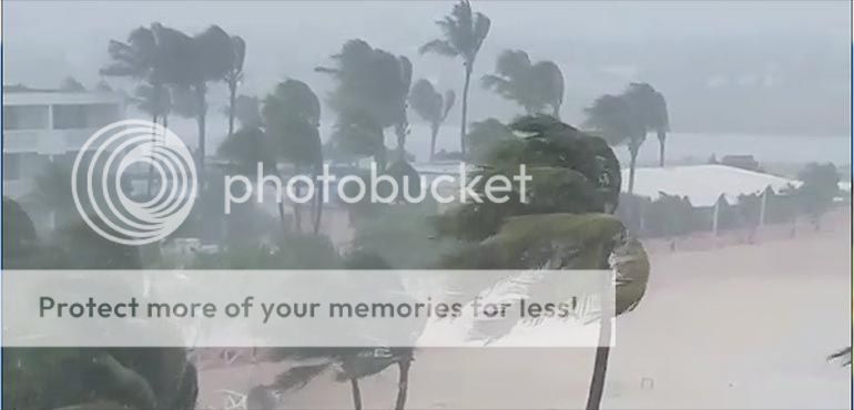
They're reporting about 6 inches of rain and some mudslides so far with rain expected until Thursday(?). Local accounts and readings are about all we'll get today without a recon flight. As of right now, it's nothing worse than a strong tropical thunderstorm.
They're reporting about 6 inches of rain and some mudslides so far with rain expected until Thursday(?). Local accounts and readings are about all we'll get today without a recon flight. As of right now, it's nothing worse than a strong tropical thunderstorm.
This post was edited on 8/27/16 at 2:28 pm
Posted on 8/27/16 at 2:22 pm to NorthEndZone
I don't care for your green lines NEZ.
Posted on 8/27/16 at 2:26 pm to tiger91
And the ECMWF (Euro), which is not included, is straight into Pensacola region.
Posted on 8/27/16 at 2:27 pm to tiger91

Looks like there may be some rotation in the NE side of the red convection. I could be just seeing things though.

Posted on 8/27/16 at 2:29 pm to LakeViewLSU
I fricking love tracking storms.

 Page 113 of 175

Popular
Back to top