- My Forums
- Tiger Rant
- LSU Recruiting
- SEC Rant
- Saints Talk
- Pelicans Talk
- More Sports Board
- Fantasy Sports
- Golf Board
- Soccer Board
- O-T Lounge
- Tech Board
- Home/Garden Board
- Outdoor Board
- Health/Fitness Board
- Movie/TV Board
- Book Board
- Music Board
- Political Talk
- Money Talk
- Fark Board
- Gaming Board
- Travel Board
- Food/Drink Board
- Ticket Exchange
- TD Help Board
Customize My Forums- View All Forums
- Show Left Links
- Topic Sort Options
- Trending Topics
- Recent Topics
- Active Topics
Started By
Message
re: 2015 Season-Long Hurricane Thread - Watching Invest 96L
Posted on 6/16/15 at 4:25 pm to OldTigahFot

Posted on 6/16/15 at 4:25 pm to OldTigahFot
 1
1


Posted on 6/23/15 at 9:53 pm to RummelTiger
my weather app is showing highs in upper 80s and lows in mid 60s for this weekend in cenla, is this happening ??
This post was edited on 6/23/15 at 9:53 pm
Posted on 6/23/15 at 9:57 pm to S
quote:
my weather app is showing highs in upper 80s and lows in mid 60s for this weekend in cenla, is this happening ??
supposedly might have a weak cold front coming through, so it's within the realm of possibilities depending what model you look at

Posted on 6/23/15 at 10:00 pm to S
the entire eastern US should be unseasonably cool next week.
I'm personally looking forward to highs in the low 70s here in Boston
I'm personally looking forward to highs in the low 70s here in Boston
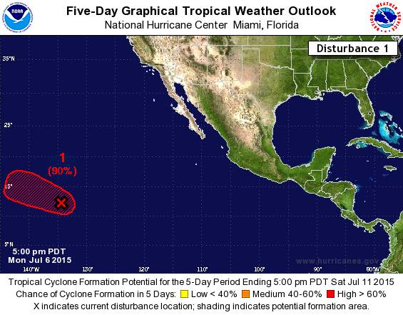
Posted on 7/6/15 at 9:56 pm to baytiger
The Pacific rages on with two super typhoons brewing
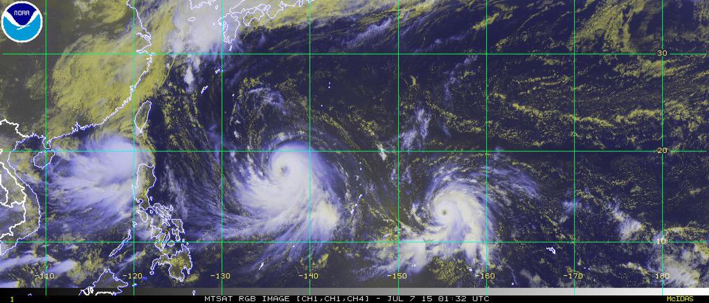
Hawaii could also be dealing with a storm later this week
Record breaking MJO during an El Nino tends to make the Pacific go crazy

Hawaii could also be dealing with a storm later this week
Record breaking MJO during an El Nino tends to make the Pacific go crazy
Posted on 7/6/15 at 10:03 pm to rds dc
What does MJO mean and what does the second graph represent?
Still no Atlantic action?
Still no Atlantic action?
Posted on 7/6/15 at 10:04 pm to rds dc
Frick
That dude coming toward Hawaii?
That dude coming toward Hawaii?

Posted on 7/7/15 at 11:10 pm to rds dc
saw this image, also, about the Pacific.
Imagine if this were the Atlantic and GOM.

Imagine if this were the Atlantic and GOM.

Posted on 7/7/15 at 11:16 pm to East Coast Band
El Niño at work
Posted on 7/13/15 at 3:45 pm to TDsngumbo
(no message)
This post was edited on 6/20/16 at 10:22 pm
Posted on 7/14/15 at 7:03 pm to Yung_Humma
This morning's Crown Weather update:
quote:
Tuesday 7/14/2015 - 9:35 am ET/8:35 am CT: Tropical Storm Claudette will track to the south of Nova Scotia today and will quickly weaken as we head into later today and Wednesday.
Now, I don’t think we are done with tropical development in close to the United States this month and in fact, I think we will see the formation of Danny within the next 2 weeks or so. This means that I am going to be keeping close tabs on any convective complexes that move offshore over the next couple of weeks and will also be closely eyeing frontal boundaries as they move offshore. My main concern area for potential tropical development from now to the end of this month is from the North and South Carolina coastline to Florida’s East Coast to the northern Gulf of Mexico.

Posted on 7/14/15 at 7:45 pm to Jim Rockford
That global warming is really holding down the tropical activity.
I can't wait for global warming to be blamed for increased activity in a few years.
I can't wait for global warming to be blamed for increased activity in a few years.
Posted on 7/23/15 at 9:14 am to Jim Rockford
quote:
I think we will see the formation of Danny within the next 2 weeks or so.
The pattern that would allow this continues but nothing has really gotten going. One interesting thing is that some of the ensemble models are showing a chance of something tracking W under the ridge. However, the equatorial wave pattern would appear to work against anything that tried that. So that leaves the most likely scenario being that anything that could form would move off to the NE and out to sea.
Posted on 7/23/15 at 9:17 am to Jim Rockford
quote:
main concern area for potential tropical development from now to the end of this month is from the North and South Carolina coastline to Florida’s East Coast to the northern Gulf of Mexico.
Boy he really narrows it down there. Just about every hurricane that has made landfall in the U.S. has hit one of those spots
Posted on 7/23/15 at 9:43 am to TDsngumbo
Im just trying to figure out how long it will be before another major hits the US, 10 years now is amazing
Posted on 7/29/15 at 9:56 am to DVinBR
NHC must be bored... none of the models are developing this Cape Verde wave at all.

Posted on 7/29/15 at 10:11 am to baytiger
TROPICAL WEATHER OUTLOOK
NWS NATIONAL HURRICANE CENTER MIAMI FL
800 AM EDT WED JUL 29 2015
For the North Atlantic...Caribbean Sea and the Gulf of Mexico:
A tropical wave accompanied by a weak low pressure system is
producing an area of showers and thunderstorms a couple of hundred
miles southeast of the Cape Verde Islands. Environmental
conditions are expected to be at least marginally conducive for
some slow development through the weekend while the disturbance
moves westward at about 15 mph.
* Formation chance through 48 hours...low...near 0 percent
* Formation chance through 5 days...low...20 percent
It sure looks impressive today. It's the first of the cape verde season waves so let's be patient and see how the rest of the season unfolds. It's only July 29th and the peak is August 11th thru September 11th.
Peak for Louisiana is the same time period.


By the way, models:

NWS NATIONAL HURRICANE CENTER MIAMI FL
800 AM EDT WED JUL 29 2015
For the North Atlantic...Caribbean Sea and the Gulf of Mexico:
A tropical wave accompanied by a weak low pressure system is
producing an area of showers and thunderstorms a couple of hundred
miles southeast of the Cape Verde Islands. Environmental
conditions are expected to be at least marginally conducive for
some slow development through the weekend while the disturbance
moves westward at about 15 mph.
* Formation chance through 48 hours...low...near 0 percent
* Formation chance through 5 days...low...20 percent
It sure looks impressive today. It's the first of the cape verde season waves so let's be patient and see how the rest of the season unfolds. It's only July 29th and the peak is August 11th thru September 11th.
Peak for Louisiana is the same time period.
By the way, models:
This post was edited on 7/29/15 at 10:14 am
Posted on 7/29/15 at 10:33 am to TDsngumbo
Heading to Lowes right now.
Posted on 7/29/15 at 10:48 pm to baytiger
quote:
NHC must be bored... none of the models are developing this Cape Verde wave at all.
It looks like they aren't even bothering with running the HWRF or GFDL for it
If, and this is a big if, the timing of the equatorial waves was faster than this might have had a chance and we might have seen something in the Gulf or off the SE already.

The TUTT is relaxing and SAL isn't going crazy, so there was actually a brief window but the forcing looks to suppress everything for the next few days.
Posted on 7/30/15 at 7:36 pm to rds dc
Saw a thing on fb about a possible system developing right off our coast this weekend. Anything to that?

 Page 23 of 26

Popular
Back to top