- My Forums
- Tiger Rant
- LSU Recruiting
- SEC Rant
- Saints Talk
- Pelicans Talk
- More Sports Board
- Fantasy Sports
- Golf Board
- Soccer Board
- O-T Lounge
- Tech Board
- Home/Garden Board
- Outdoor Board
- Health/Fitness Board
- Movie/TV Board
- Book Board
- Music Board
- Political Talk
- Money Talk
- Fark Board
- Gaming Board
- Travel Board
- Food/Drink Board
- Ticket Exchange
- TD Help Board
Customize My Forums- View All Forums
- Show Left Links
- Topic Sort Options
- Trending Topics
- Recent Topics
- Active Topics
Started By
Message
re: 2015 Season-Long Hurricane Thread - Watching Invest 96L
Posted on 8/14/15 at 5:31 pm to rds dc

Posted on 8/14/15 at 5:31 pm to rds dc
Im hoping we get a couple storms form that just sit out in the Atlantic in the next few weeks so we have something current to look at in the tropical class im taking.
 0
0

Posted on 8/14/15 at 5:32 pm to Pedro

just realized this updates with the NWS update
This post was edited on 8/14/15 at 5:33 pm
Posted on 8/16/15 at 9:05 am to Pedro
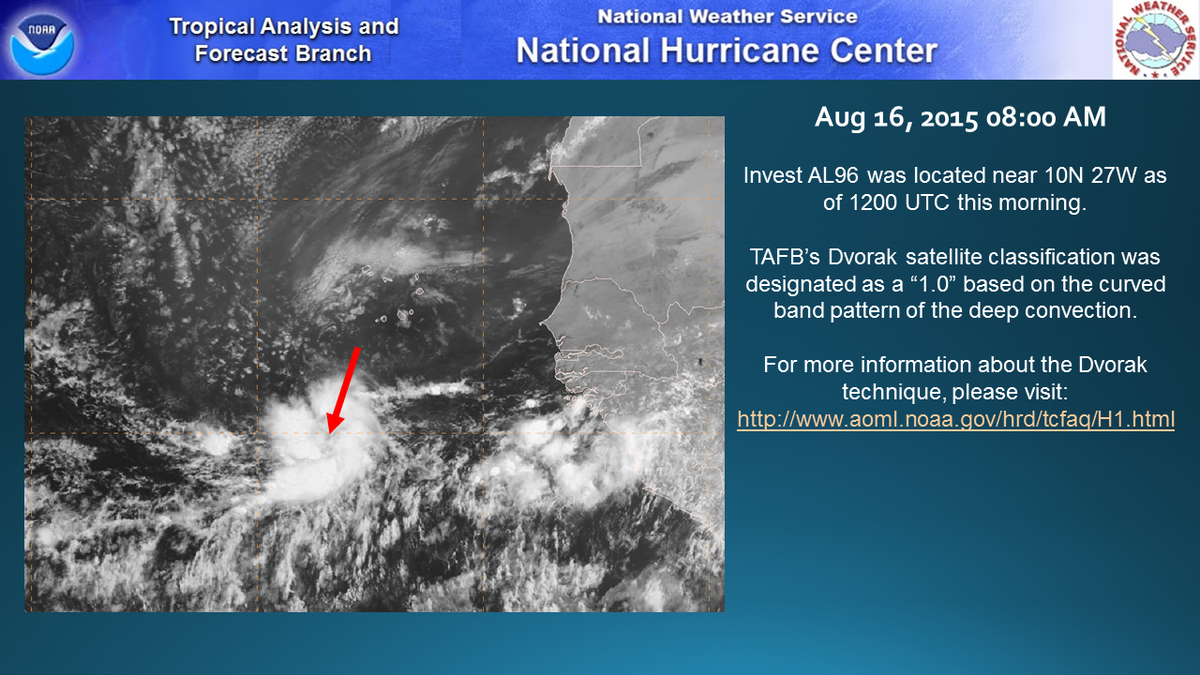

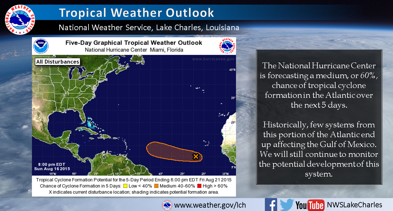
NHC has disginated another long shot invest out over the Atlantic this morning. The Euro tracks a weak system generally westward next week towards the islands. Conditions don't appear overly favorable for development and the systems best chance is probably to stay as far south as possible. The two systems in the Pacific look to reshuffle the pattern across N. America in the long range and that will increase uncertainty associated with the track of 96L, if the system actually develops.
Posted on 8/16/15 at 9:39 pm to rds dc

noticed this when i was looking at the NHC discussion last night and wondered why they werent even mentioning it. seemed like it was fairly organized.
Posted on 8/16/15 at 9:41 pm to Pedro
IIRC, the ones that get organized that far out usually recurve. It's the ones that just mosey along across the Atlantic as an area of disturbed weather that you have to keep an eye on.
Posted on 8/16/15 at 9:51 pm to Jim Rockford
seems like this ones seems to be hanging south for the most part.

Posted on 8/16/15 at 9:55 pm to Pedro
quote:
The SHIPS model shows that the disturbance could become a depression anytime, a tropical storm by Monday morning and a hurricane by 60 hours, which is early Wednesday morning.
quote:
The morning run of the GFS was not very bullish on the storm becoming very strong, running it into some more substantial shear as it moves into the middle of the Atlantic between the Caribbean and the Cape Verdes. It also turns the system out to the northeast before it reaches the islands.
Interestingly, the GFS develops a couple of additional tropical cyclones behind this one, with the next one reaching the islands around the first of the month. With a ridge developed back to the north of it, that system could get into the Caribbean.
LINK
Posted on 8/17/15 at 10:29 am to East Coast Band


Posted on 8/17/15 at 10:32 am to Pedro
NOT A FAN of this Season Long Thread
NOT A FAN
NOT A FAN

Posted on 8/17/15 at 10:34 am to TDsngumbo
You should start a new thread
This post was edited on 8/17/15 at 10:35 am

Posted on 8/17/15 at 10:48 am to Chicken
quote:
You should start a new thread
I'll admit that work has prevented me from updating this thread as often as I would like. I'll update the title and info in the OP for this current storm but why the hate? Why should I start a new thread? Do we really want a new thread for each storm that begins brewing?
If a storm makes a serious threat to Louisiana, believe me I will update every few minutes.
This post was edited on 8/17/15 at 10:59 am
Posted on 8/17/15 at 10:56 am to Chicken
Im not sure this is worthy of a thread yet. a good chunk of models still have this not being a major threat to the states
Posted on 8/17/15 at 10:59 am to Pedro

Posted on 8/22/15 at 9:20 pm to TDsngumbo
98L has been designated way out in the Atlantic

Notice the SAL coming off Africa, just like Danny
Notice the SAL coming off Africa, just like Danny
This post was edited on 9/5/15 at 1:02 pm

 Page 26 of 26


Popular
Back to top