- My Forums
- Tiger Rant
- LSU Recruiting
- SEC Rant
- Saints Talk
- Pelicans Talk
- More Sports Board
- Fantasy Sports
- Golf Board
- Soccer Board
- O-T Lounge
- Tech Board
- Home/Garden Board
- Outdoor Board
- Health/Fitness Board
- Movie/TV Board
- Book Board
- Music Board
- Political Talk
- Money Talk
- Fark Board
- Gaming Board
- Travel Board
- Food/Drink Board
- Ticket Exchange
- TD Help Board
Customize My Forums- View All Forums
- Show Left Links
- Topic Sort Options
- Trending Topics
- Recent Topics
- Active Topics
Started By
Message
Posted on 8/27/16 at 9:19 am to Jim Rockford
quote:the early euro runs that got this thread started said it would fire today.
They're all fired up on the Stomr2k board this morning. They say it's finally taking off.
sure the models have backed off a bit, but today is the day for it to happen.
Posted on 8/27/16 at 9:22 am to deuce985
quote:
Which model is typically most accurate under these conditions at this time of year?
Hard to say, all models struggle with storm formation (cyclogenesis). Once a storm forms it typically goes Euro and then everyone else.
Posted on 8/27/16 at 9:27 am to Jim Rockford
quote:
They're all fired up on the Stomr2k board this morning. They say it's finally taking off.
I'm not seeing much. Surface obs do indicate there could be a broad circulation down there and there is some convection going off. It would probably take an extended period of vigorous convection to tighten anything up. Also, the mid level vort is displaced well away from any low level spin.
Posted on 8/27/16 at 9:31 am to EZE Tiger Fan
quote:
Where is the most reliable reflection of the Euro model? I can't find one that is consistent
Tropicaltidbits.com offers the best free Euro data. It is provided in 24 hr panels, so you miss a lot of what happens but it is still better than nothing.
Posted on 8/27/16 at 9:44 am to rds dc
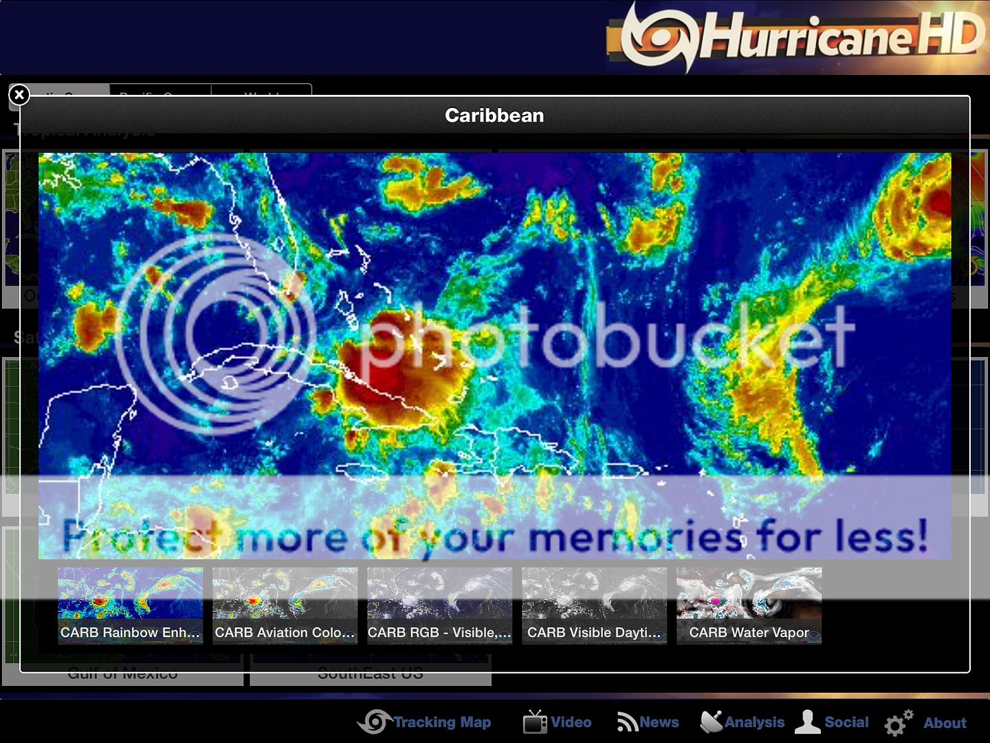
quote:yeah, there's a lot of convection today but there's no rotation in the tops whatsoever. It seems like the visible surface circulation is weakening too.
I'm not seeing much. Surface obs do indicate there could be a broad circulation down there and there is some convection going off. It would probably take an extended period of vigorous convection to tighten anything up. Also, the mid level vort is displaced well away from any low level spin.
What may be happening is that surface circulation is reconsolidating below the convection, but the nonrotating convection kind of leaves me doubtful of that. I think we've gotta just be in a wait-and-see mode for today.
Posted on 8/27/16 at 9:56 am to baytiger
The imagery supports the NHC's forecast for dropping the 5 day probability for tropical storm development to less than 50%.
This system will be known for being the most watched, most analyzed thunderstorm in history.
This system will be known for being the most watched, most analyzed thunderstorm in history.
Posted on 8/27/16 at 10:14 am to LSURussian

I think we are at a pivotal moment for 99L. Looks like it is trying to get itself together this morning. If it can't get over the hump this time feels like it's obituary is gonna be written.
This post was edited on 8/27/16 at 10:18 am
Posted on 8/27/16 at 10:15 am to Scoop
That looks scary.
I'm scared. Nobody's scared?
I'm scared. Nobody's scared?
Posted on 8/27/16 at 10:27 am to LSURussian
quote:
This system will be known for being the most watched, most analyzed thunderstorm in history.
I approve this message.
Posted on 8/27/16 at 10:28 am to LSURussian
If we faced a situation like we saw with Katrina, Rita or Ike again there would be mass panic from Miami to Corpus.
Social media is out of control. Every storm plot freaks people out. Seeing these spaghetti plots does way more harm than good.
Social media is out of control. Every storm plot freaks people out. Seeing these spaghetti plots does way more harm than good.
This post was edited on 8/27/16 at 10:37 am
Posted on 8/27/16 at 10:32 am to LSURussian
Let's pretend like the flood that just happened wasn't just a thunderstorm. Have an up vote.
Posted on 8/27/16 at 10:33 am to doubleb
quote:
Kattina

This post was edited on 8/27/16 at 10:34 am
Posted on 8/27/16 at 10:50 am to doubleb
quote:
Social media is out of control. Every storm plot freaks people out. Seeing these spaghetti plots does way more harm than good.
And Obama is trying to secretly take over Texas, and physic spies from China try to steal your minds elation, and Elivs is Everywhere... maybe people should start thinking for themselves and stop believing everything they see on social media?
Posted on 8/27/16 at 10:53 am to theunknownknight
quote:
Let's pretend like the flood that just happened wasn't just a thunderstorm.

Posted on 8/27/16 at 10:58 am to LSURussian
quote:
This system will be known for being the most watched, most analyzed thunderstorm in history.
Yeah I've never watched an invest as close as I've watched this one. I've literally been watching it since it was at the Cape Verde islands off the coast of Africa.
I'm guessing this is because of how overdue the US is for a storm. We haven't seen a real threat in a while, so anytime the models bring a low into the gulf...people are going to take it very seriously.
Popular
Back to top


 0
0


