- My Forums
- Tiger Rant
- LSU Recruiting
- SEC Rant
- Saints Talk
- Pelicans Talk
- More Sports Board
- Fantasy Sports
- Golf Board
- Soccer Board
- O-T Lounge
- Tech Board
- Home/Garden Board
- Outdoor Board
- Health/Fitness Board
- Movie/TV Board
- Book Board
- Music Board
- Political Talk
- Money Talk
- Fark Board
- Gaming Board
- Travel Board
- Food/Drink Board
- Ticket Exchange
- TD Help Board
Customize My Forums- View All Forums
- Show Left Links
- Topic Sort Options
- Trending Topics
- Recent Topics
- Active Topics
Started By
Message
re: Tornado! Threat Clearing Louisiana
Posted on 4/30/17 at 5:05 am to CheniereTiger108

Posted on 4/30/17 at 5:05 am to CheniereTiger108
quote:
This was the weekend of the canton trade days
My SO was supposed to be there this weekend. I'm so grateful that she didn't go. Praying for the people that were there. Some that we know.
 1
1

Posted on 4/30/17 at 6:21 am to bencoleman
quote:
@NWSJacksonMS
2m
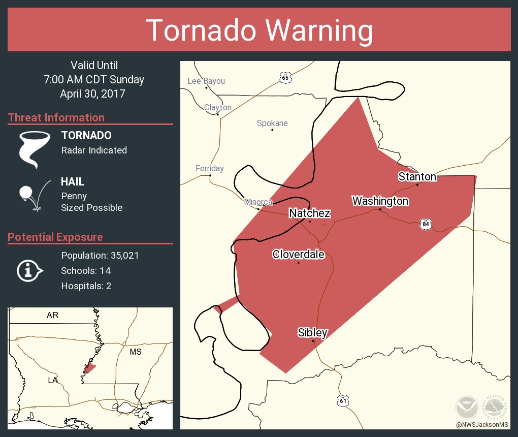
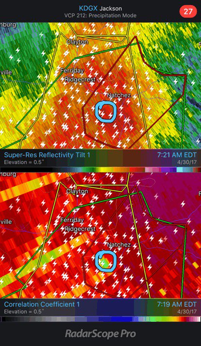
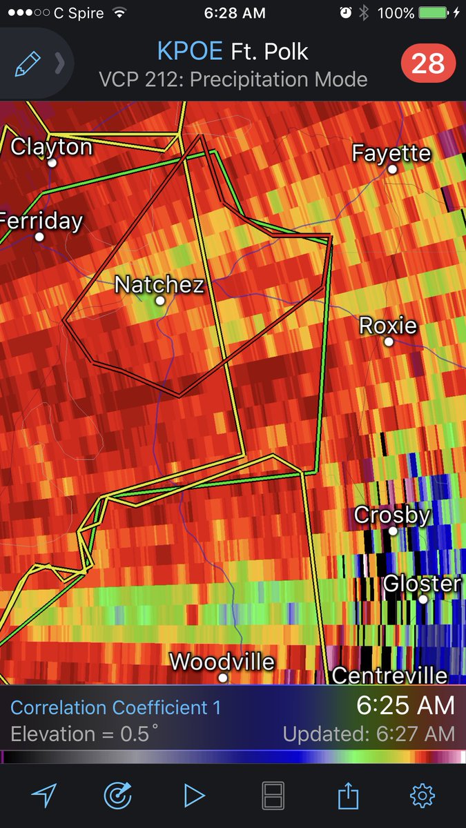
Debris signature noted: confirmed tornado!
quote:
@NWStornado Tornado Warning including Natchez MS, Vidalia LA, Morgantown MS until 7:00 AM CDT
This post was edited on 4/30/17 at 6:24 am
Posted on 4/30/17 at 6:27 am to GEAUXmedic
The rain and lightning have been insane in Marksville overnight. Been pouring since at least 1:30am when a severe t-storm warning was issued. Here's to hopin Hwy 1 back to 49 doesn't flood...or doesn't stay flooded.
Posted on 4/30/17 at 6:30 am to GEAUXmedic
Yep. It's hairy outside right now
Posted on 4/30/17 at 6:30 am to ChandlerB03
quote:
Yep. It's hairy outside right now
You OK?
edit: it's downtown
This post was edited on 4/30/17 at 6:32 am
Posted on 4/30/17 at 6:31 am to GEAUXmedic
Geaux, whats a good weather site for A PC besides the weather channel
Posted on 4/30/17 at 6:33 am to ole man
quote:
Geaux, whats a good weather site for A PC besides the weather channel
weather.gov, Accuweather, forecast.io.
Weather.com, wunderground, and intellicast.com are all owned by the same company, and I don't personally care for any of them./
Posted on 4/30/17 at 6:35 am to GEAUXmedic
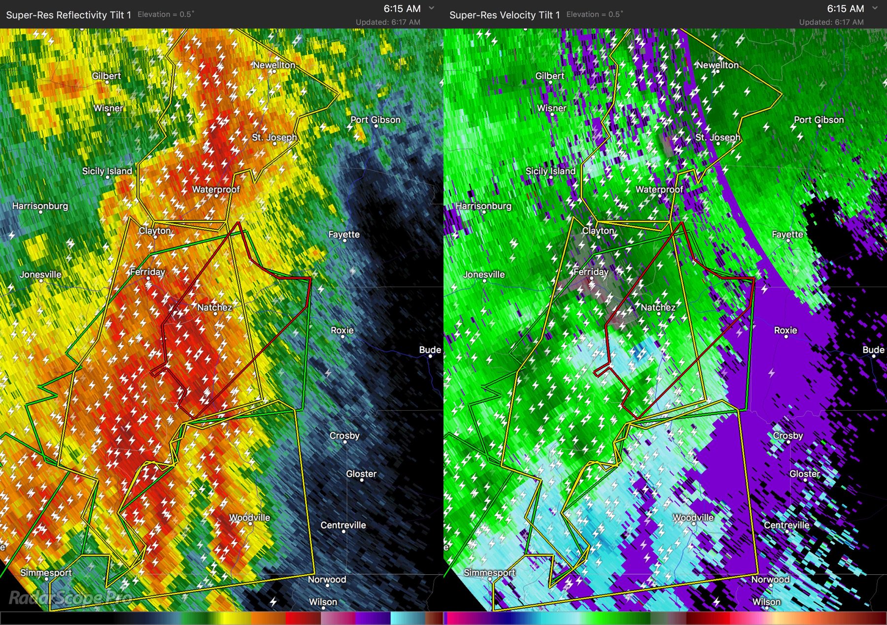
The Natchez tornado is heavily rain wrapped, no one will see it coming.
shite.. this was my 30,000th post.
shite.. this was my 30,000th post.
This post was edited on 4/30/17 at 6:55 am
Posted on 4/30/17 at 6:38 am to GEAUXmedic
We are in Vidalia. Can hear the sirens going off in Natchez
Posted on 4/30/17 at 6:43 am to GEAUXmedic

Posted on 4/30/17 at 6:50 am to GEAUXmedic
It is screaming through Lafayette right now
Posted on 4/30/17 at 6:50 am to GEAUXmedic
Those storms ahead of the front should hold off and combine with the main line before making it to SELA. Threats for today will mainly be damaging winds >50 mph and flooding. Hail to a lesser extent, and tornadoes mainly well north into MS. Wednesday will bring another primarily heavy rain/flooding threat with strong to severe storms.

Posted on 4/30/17 at 6:51 am to GEAUXmedic
Alright... it's Vicksburg's turn.
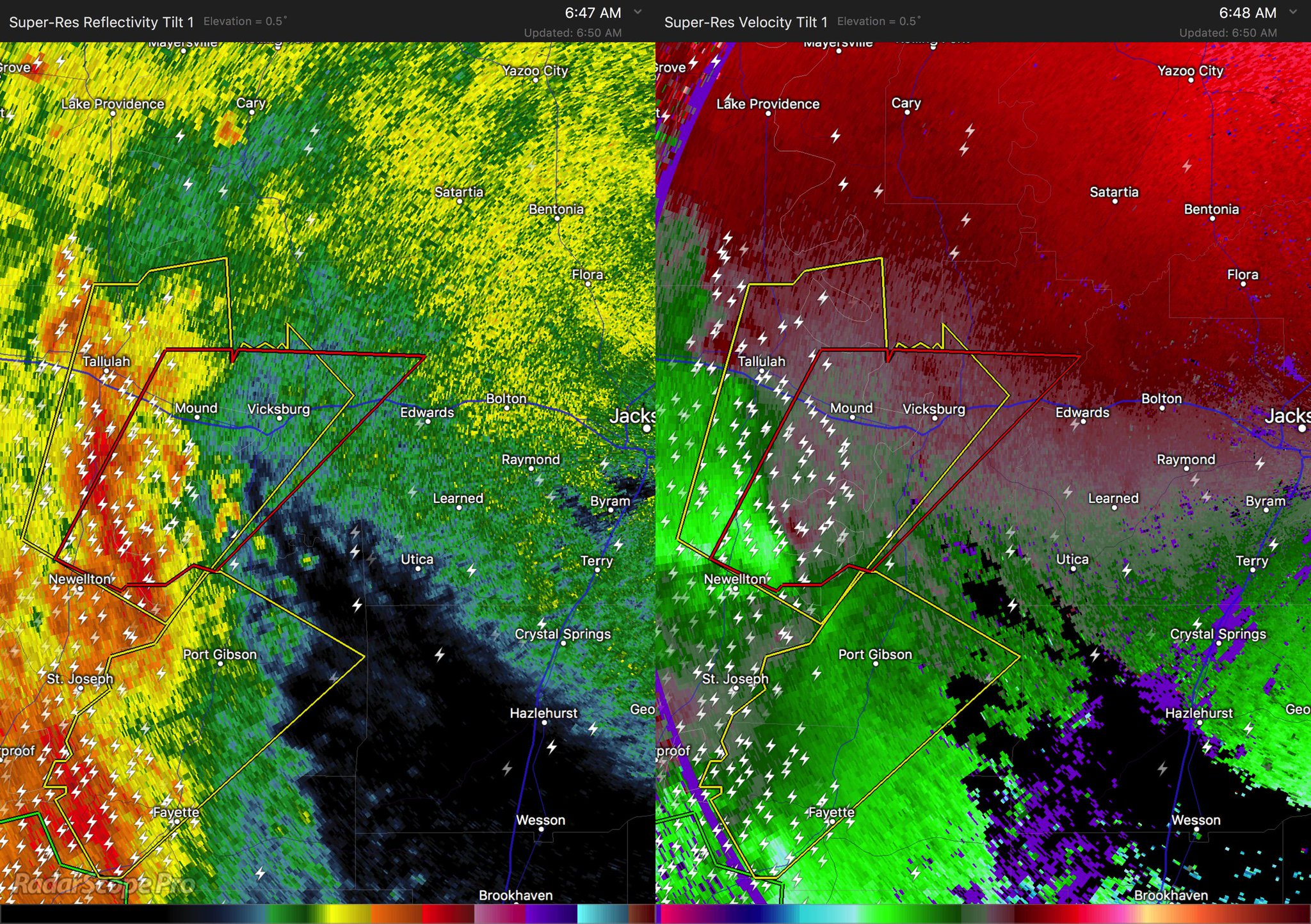
quote:
* Until 745 AM CDT
* At 643 AM CDT, a severe thunderstorm capable of producing a tornado
was located near Newellton, or 20 miles south of Tallulah, moving
northeast at 45 mph.
HAZARD...Tornado.
SOURCE...Radar indicated rotation.
IMPACT...Flying debris will be dangerous to those caught without
shelter. Mobile homes will be damaged or destroyed.
Damage to roofs, windows, and vehicles will occur. Tree
damage is likely.
* This dangerous storm will be near...
Afton around 650 AM CDT.
Yokena around 700 AM CDT.
Vicksburg and Le Tourneau around 705 AM CDT.
Bovina around 725 AM CDT.
Flowers around 730 AM CDT.
This post was edited on 4/30/17 at 6:53 am
Posted on 4/30/17 at 6:52 am to SOLA
We have some real heavy shite over us just east of Opelousas right now. Woke up to heavy rain, and it quickly turned into heavy rain and loud claps of lightning.
Posted on 4/30/17 at 6:53 am to Cowboyfan89
I heard 1 ft of water above land in coco marina, powers out down there just from the wind/tide.
This post was edited on 4/30/17 at 6:53 am
Posted on 4/30/17 at 7:19 am to GEAUXmedic
Just staring to get hit. New Roads area. Power keeps knocking off. 
Posted on 4/30/17 at 7:26 am to fishfighter
Confirmed tornado near Vicksburg

Posted on 4/30/17 at 7:26 am to GEAUXmedic


Posted on 4/30/17 at 7:32 am to GEAUXmedic
Two storms in MS are showing signs of debris. The one near Vicksburg, and the other is SW of Jackson.
Posted on 4/30/17 at 7:33 am to Roll Tide Ravens
Confirmed tornado on the furthest south of the three tornado warned storms.

 Page 9 of 17

Popular
Back to top