- My Forums
- Tiger Rant
- LSU Recruiting
- SEC Rant
- Saints Talk
- Pelicans Talk
- More Sports Board
- Fantasy Sports
- Golf Board
- Soccer Board
- O-T Lounge
- Tech Board
- Home/Garden Board
- Outdoor Board
- Health/Fitness Board
- Movie/TV Board
- Book Board
- Music Board
- Political Talk
- Money Talk
- Fark Board
- Gaming Board
- Travel Board
- Food/Drink Board
- Ticket Exchange
- TD Help Board
Customize My Forums- View All Forums
- Show Left Links
- Topic Sort Options
- Trending Topics
- Recent Topics
- Active Topics
Started By
Message
Tropical Depression Bonnie
Posted on 5/28/16 at 3:40 pm
Posted on 5/28/16 at 3:40 pm
Quickly downgraded as it came ashore.


This post was edited on 5/29/16 at 11:54 am
Posted on 5/28/16 at 3:40 pm to baytiger
quote:
WTNT32 KNHC 282030
TCPAT2
BULLETIN
TROPICAL STORM BONNIE ADVISORY NUMBER 5
NWS NATIONAL HURRICANE CENTER MIAMI FL AL022016
500 PM EDT SAT MAY 28 2016
...DEPRESSION STRENGTHENS INTO TROPICAL STORM BONNIE...
...LOCALLY HEAVY RAINFALL SPREADING ACROSS COASTAL AREAS OF SOUTH
CAROLINA...
SUMMARY OF 500 PM EDT...2100 UTC...INFORMATION
----------------------------------------------
LOCATION...31.1N 79.4W
ABOUT 120 MI...190 KM SE OF BEAUFORT SOUTH CAROLINA
ABOUT 125 MI...195 KM SSE OF CHARLESTON SOUTH CAROLINA
MAXIMUM SUSTAINED WINDS...40 MPH...65 KM/H
PRESENT MOVEMENT...NW OR 320 DEGREES AT 10 MPH...17 KM/H
MINIMUM CENTRAL PRESSURE...1008 MB...29.77 INCHES
WATCHES AND WARNINGS
--------------------
CHANGES WITH THIS ADVISORY:
None.
SUMMARY OF WATCHES AND WARNINGS IN EFFECT:
A Tropical Storm Warning is in effect for...
* Savannah River to Little River Inlet South Carolina
A Tropical Storm Warning means that tropical storm conditions are
expected somewhere within the warning area, in this case within the
next 12 hours.
For storm information specific to your area, including possible
inland watches and warnings, please monitor products issued by your
local National Weather Service forecast office.
DISCUSSION AND 48-HOUR OUTLOOK
------------------------------
At 500 PM EDT (2100 UTC), the center of Tropical Storm Bonnie was
located by satellite and NOAA Doppler radars near latitude 31.1
North, longitude 79.4 West. Bonnie is moving toward the northwest
near 10 mph (17 km/h). This general motion, accompanied by a
decrease in forward speed, is expected through this evening and on
Sunday as the system nears the coast within the warning area.
Maximum sustained winds have increased to near 40 mph (65 km/h) with
higher gusts. Some additional strengthening is possible tonight as
Bonnie moves over the warm waters of the Gulf Stream. Gradual
weakening is forecast on Sunday.
Tropical-storm-force winds extend outward up to 60 miles (95 km)
from the center, mainly to the northwest of the center.
The estimated minimum central pressure is 1008 mb (29.77 inches).
HAZARDS AFFECTING LAND
----------------------
WIND: Tropical storm conditions are expected to first reach the
coast within the warning area later tonight or early Sunday.
RAINFALL: Bonnie is expected to produce total rainfall accumulations
of 1 to 3 inches with maximum totals of 5 inches from eastern
South Carolina through southeastern North Carolina.
STORM SURGE: Storm surge inundation of 1 to 2 feet above ground
level is possible within the tropical storm warning area during the
next high tide on Sunday morning.
SURF: Bonnie is expected to produce life-threatening surf and
rip current conditions along portions of the southeastern United
States coast through the weekend. Please consult products from your
local weather office.
TORNADOES: An isolated tornado or two will be possible late tonight
and early Sunday over the immediate coastal region from central
South Carolina through southern North Carolina.
NEXT ADVISORY
-------------
Next intermediate advisory at 800 PM EDT.
Next complete advisory at 1100 PM EDT.
$$
Forecaster Stewart
Posted on 5/28/16 at 3:44 pm to SuperSaint
it's definitely a missed opportunity from the NHC to not name the next one Clyde.
Colin?

Posted on 5/28/16 at 3:49 pm to baytiger
They usually don't count until August. Sometimes late July also.
Posted on 5/28/16 at 3:58 pm to baytiger
Exposed center with downshear convection... winds on radar are almost assuredly elevated and associated with a mid level meso. Some higher gust probably mixing down in the stronger convection but this really is a sad excuse for a TS.


Posted on 5/28/16 at 4:00 pm to rds dc
Not a legit weather thread until PJ gives us his breakdown.
Posted on 5/28/16 at 4:05 pm to rds dc
quote:
winds on radar are almost assuredly elevated and associated with a mid level meso. S
it's over 100mi from the radar site... there's no way they can get surface winds from that. I'd be really surprised if there's any TS force winds found by recon tonight. There's just no support
Posted on 5/28/16 at 4:07 pm to baytiger
Baytiger will go down in history as the most vital resource during Gustav in 2008 with his Michael Phelps avatar.
Posted on 5/28/16 at 4:11 pm to Paul Allen
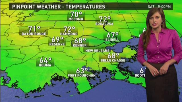
For your Pinpoint Weather Forecast, I'm WWL meteorologist Alexandra Cranford.


Posted on 5/28/16 at 4:15 pm to baytiger
quote:
it's over 100mi from the radar site... there's no way they can get surface winds from that. I'd be really surprised if there's any TS force winds found by recon tonight. There's just no support
Exactly, this whole sequence has been odd with the NHC seeming overly aggressive from the get go. I guess they figure it's better to play it safe on a holiday weekend.
Posted on 5/28/16 at 4:15 pm to BRgetthenet
I wonder if it's rotation could pull down some dryer air on the western side. I could handle that.
Posted on 5/28/16 at 4:20 pm to rds dc
It seems over the past decade the NWS as a whole has been overly aggressive.
Posted on 5/28/16 at 4:40 pm to GEAUXmedic
quote:
It seems over the past decade the NWS as a whole has been overly aggressive.
More "storms", more funding? More "storms", more climate change, therefore more impetus for tax hikes?
Posted on 5/28/16 at 4:49 pm to baytiger
The mesa cyclone thunderstorm that came through Baton Rouge two Thursdays ago had a better center of circulation than that mass of clouds in your loop....
Posted on 5/28/16 at 4:55 pm to baytiger
My Bonnie lies over the ocean, my Bonnie lies over the sea
Posted on 5/28/16 at 7:58 pm to rds dc
SFMR found 36 kt, so I guess it's real? 
Posted on 5/28/16 at 8:53 pm to rds dc
quote:Or, more hype means better ratings. With a media bent on selling climate change as the cause for all natural disasters, even better.
I guess they figure it's better to play it safe on a holiday weekend.
For the "experts" in the "prediction" profession, now they have to meet them. That is, until they're revised around early October, so they can still claim they were right.
While forecasting the path of tropical systems has improved immensely in the last 20 years, predicting the number of storms has been no more reliable than a dart board.
Posted on 5/28/16 at 9:02 pm to BRgetthenet
quote:Buchtel showing up on Cohen's First News Early Edition from 5-6AM and giving the day's weather, is/was tGOAT... best would be when Dave would describe what she is wearing and then you saw her on the 4WWL Eyewitness set
For your Pinpoint Weather Forecast, I'm WWL meteorologist Alexandra Cranford.
Posted on 5/28/16 at 9:11 pm to OweO
quote:
Not a legit weather thread until PJ gives us his breakdown.
Popular
Back to top


 7
7


