- My Forums
- Tiger Rant
- LSU Recruiting
- SEC Rant
- Saints Talk
- Pelicans Talk
- More Sports Board
- Fantasy Sports
- Golf Board
- Soccer Board
- O-T Lounge
- Tech Board
- Home/Garden Board
- Outdoor Board
- Health/Fitness Board
- Movie/TV Board
- Book Board
- Music Board
- Political Talk
- Money Talk
- Fark Board
- Gaming Board
- Travel Board
- Food/Drink Board
- Ticket Exchange
- TD Help Board
Customize My Forums- View All Forums
- Show Left Links
- Topic Sort Options
- Trending Topics
- Recent Topics
- Active Topics
Started By
Message
re: Hurricane Season - Random Posts Thread - Gulf Record 1,058 Days
Posted on 8/5/16 at 10:30 pm to Y.A. Tittle
Posted on 8/5/16 at 10:30 pm to Y.A. Tittle
quote:
Remember when Al Gore made a movie with the satellite image of Hurricane Katrina as the movie poster?
No, but I'm sure he had the good stuff, since he invented the internet
 1
1

Posted on 8/6/16 at 7:12 pm to rds dc
Not sure that I've ever seen forecast totals this high and the 12z Euro shows nearly 50" for areas SE of Panama City, FL

Posted on 8/6/16 at 7:17 pm to rds dc
Damn, is it possible this can shift a little west and impact Louisiana more or does it look to stay just east of here.
Posted on 8/6/16 at 7:26 pm to rds dc
It seems, the last few years, that there have been waves that should have formed into storms but could never get really organized because they were moving so fast. The storm last week seemed to have the same problem. Will this continue?
Posted on 8/7/16 at 12:15 am to rds dc
Really curious what does 12z mean?
Posted on 8/7/16 at 12:49 am to Dizz
Weather models are done using Greenwich time as a standard, and the "z" indicates Greenwich time is being used. 0z is midnight, 6z is 6AM 12z is noon, and 18z is 6PM.
Posted on 8/7/16 at 9:04 am to lsuman25
quote:
Damn, is it possible this can shift a little west and impact Louisiana more or does it look to stay just east of here.
There was a pretty big westward shift on the overnight models but it is too soon to tell if that is a trend or just the models thrashing around. The models will probably struggle with this upcoming period given the complex nature of the setup over the NE Gulf and what is going on in the Pacific.

Posted on 8/7/16 at 9:17 am to rds dc
quote:
ULL
They'll get mar that you didn't call them Louisiana.
Posted on 8/7/16 at 9:35 am to ptra
quote:
It seems, the last few years, that there have been waves that should have formed into storms but could never get really organized because they were moving so fast. The storm last week seemed to have the same problem. Will this continue?
A portion of the fast motion can be attributed to many of the waves moving across the Atlantic having poor structure. A vertically stacked wave with deep convection is going to move slower and have better prospects for development. There has been more dry stable air across the Atlantic MDR the past few seasons making it hard for waves coming off Africa to develop and that trend is continuing this season:

and if this MJO forecast holds, then that trend will likely continue as we move towards September and peak season:

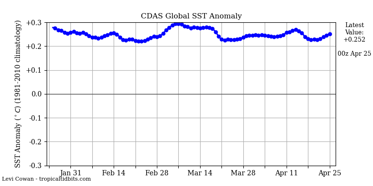
There has been a lot of research over the past few years on this topic. One of the things that seems likely to me is that warmer global SSTs are altering the large scale atmospheric circulations:
The expansion of the Hadley Cell appears to be driving a portion of the changes in the Atlantic MDR that might be making it harder for systems to form in the MDR.

Posted on 8/7/16 at 9:51 am to rds dc
It's been pouring rain here for 3 days straight. We're sending some waves now.
Posted on 8/7/16 at 11:00 am to rds dc
Thank You

Posted on 8/9/16 at 8:06 pm to rds dc
quote:
rds dc
Thoughts on development in the gulf?

Posted on 8/9/16 at 9:37 pm to jlu03
quote:
Thoughts on development in the gulf?
Too close to land, most of the broad circulation is on shore. If it was 100 or so miles south then it would probably be a TD or TS. There are signs of a sloppy LLC (would probably tighten up if completely over the Gulf), the upper level low has been replaced with an anticyclone, and it is probably warm core by this point.
The NHC highlights it but gives it 0% chance to develop in both the 48 hr and 5 day outlook, this is down from 30% a few days ago. Then beyond that, things look to potentially stay calm for the next two weeks or so with the MJO in Phase 6 and most of the Atlantic basin looking unfavorable overall:


Posted on 8/9/16 at 9:50 pm to rds dc
El Niño

Posted on 8/9/16 at 10:53 pm to rds dc
quote:
Earl goes on to be Javier in the EPAC:
I really can't stand that. The storm should keep its name.
Posted on 8/12/16 at 4:02 pm to rds dc
Welp...
quote:
Crown Weather Services Friday 8/12/2016 - 1:15 pm ET/12:15 pm CT: Catastrophic flooding is expected to continue this afternoon through tonight and probably through Saturday across south-central and southeastern Louisiana and southwestern Mississippi. Areas west of Interstate 55 may see an additional 10 to 20 inches of rainfall on top of what has already fallen.
Everyone across south-central and southeastern Louisiana and southwestern Mississippi should be prepared to take quick action to save life and property from flash flooding. I cannot stress the urgency of this situation as this is a life-threatening situation.
Finally, the long range model guidance are pointing to the Atlantic Basin waking up in a hurry during the week of August 22nd and we think that the period from late August through all of September through much of October could be particularly active across the Atlantic.

 Page 3 of 3


Popular
Back to top