- My Forums
- Tiger Rant
- LSU Recruiting
- SEC Rant
- Saints Talk
- Pelicans Talk
- More Sports Board
- Fantasy Sports
- Golf Board
- Soccer Board
- O-T Lounge
- Tech Board
- Home/Garden Board
- Outdoor Board
- Health/Fitness Board
- Movie/TV Board
- Book Board
- Music Board
- Political Talk
- Money Talk
- Fark Board
- Gaming Board
- Travel Board
- Food/Drink Board
- Ticket Exchange
- TD Help Board
Customize My Forums- View All Forums
- Show Left Links
- Topic Sort Options
- Trending Topics
- Recent Topics
- Active Topics
Started By
Message
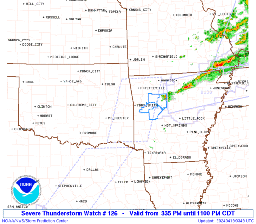
re: Bad weather heading our way
Posted on 4/27/15 at 8:39 am to roguetiger15
Posted on 4/27/15 at 8:39 am to roguetiger15
same here in Broussard. 8:20 looked like 5:00am. Raining like a mofo at the moment. Haven't seen it this bad on a long time.
lots o' rain too. Like shite tons of it.
lots o' rain too. Like shite tons of it.
 0
0

Posted on 4/27/15 at 8:39 am to roguetiger15
It was looking like night in Lafayette and then the bottom fell out. Raining sideways.

Posted on 4/27/15 at 8:39 am to TheIndulger
I would wait until this weather passes.
Posted on 4/27/15 at 8:39 am to TigerHam85
Trees down all up in my hood
Posted on 4/27/15 at 8:40 am to TheIndulger
baseball size hail in carencro. reports are saying
two tarnados now reported. carencro and duson
two tarnados now reported. carencro and duson
This post was edited on 4/27/15 at 8:44 am
Posted on 4/27/15 at 8:43 am to roguetiger15
I'd have to see pics. That's huge
Posted on 4/27/15 at 8:43 am to roguetiger15
This was at my office at 8:10 just west of Lafayette. Never seen anything like this, it went from daylight and overcast to as dark as night in minutes then the bottom fell out. Seems to have settled down now.
LINK
LINK
Posted on 4/27/15 at 8:43 am to roguetiger15

TORNADO WARNING
NATIONAL WEATHER SERVICE NEW ORLEANS LA
836 AM CDT MON APR 27 2015
THE NATIONAL WEATHER SERVICE IN NEW ORLEANS HAS ISSUED A
* TORNADO WARNING FOR...
SOUTH CENTRAL WEST FELICIANA PARISH IN SOUTHEASTERN LOUISIANA...
POINTE COUPEE PARISH IN SOUTHEASTERN LOUISIANA...
* UNTIL 900 AM CDT
* AT 836 AM CDT...DOPPLER RADAR INDICATED A SEVERE THUNDERSTORM
CAPABLE OF PRODUCING A TORNADO. THIS DANGEROUS STORM WAS LOCATED
NEAR MELVILLE...AND MOVING EAST AT 40 MPH.
* LOCATIONS IMPACTED INCLUDE...
NEW ROADS...LIVONIA...MARINGOUIN...FORDOCHE...MORGANZA AND LOTTIE.
PRECAUTIONARY/PREPAREDNESS ACTIONS...
TAKE COVER NOW. MOVE TO A BASEMENT OR AN INTERIOR ROOM ON THE LOWEST
FLOOR OF A STURDY BUILDING. AVOID WINDOWS. IF YOU ARE IN A MOBILE
HOME OR OUTDOORS...MOVE TO THE CLOSEST SUBSTANTIAL SHELTER AND
PROTECT YOURSELF FROM FLYING DEBRIS.
HEAVY RAINFALL MAY OBSCURE THIS TORNADO. DO NOT WAIT TO SEE OR HEAR
THE TORNADO. TAKE COVER NOW.
THIS CLUSTER OF THUNDERSTORMS IS CAPABLE OF PRODUCING TORNADOES AND
WIDESPREAD SIGNIFICANT WIND DAMAGE. DO NOT WAIT TO SEE OR HEAR THE
TORNADO. FOR YOUR PROTECTION MOVE TO AN INTERIOR ROOM ON THE LOWEST
FLOOR OF YOUR HOME OR BUSINESS.
&&
Posted on 4/27/15 at 8:43 am to roguetiger15
Tornado warning here.

Posted on 4/27/15 at 8:43 am to roguetiger15
Tornado warning for New Roads and Baker.
Posted on 4/27/15 at 8:44 am to GEAUXmedic
again, stay inside. two tornados reported now
Posted on 4/27/15 at 8:44 am to sec13rowBBseat28
I like just west of Lafayette, and what passed through here this morning was some of the worst weather I've ever driven through. Black as night, very strong winds blowing me around, blinding rain.
Posted on 4/27/15 at 8:45 am to uway
Tornado watch extended east to include all of SE Louisiana

Posted on 4/27/15 at 8:45 am to roguetiger15
I will never be able to get fill dirt for my slab at this rate.
Posted on 4/27/15 at 8:47 am to GEAUXmedic
Just reading gulfcoastwx Medic, velocities of 131 mph (I assume radar estimate) in that tornado warned cell! Anyone up that way should take cover now!
Posted on 4/27/15 at 8:47 am to Jimbeaux28
listening to radio..multiple multiple traffic lights out. water over the roads already in south lafayette.
Posted on 4/27/15 at 8:47 am to yellowfin
You supply the saw and I'll have firewood for years for a minimal cost
Posted on 4/27/15 at 8:47 am to GEAUXmedic
WOW, radar velocities ~130 mph near New Roads..

Posted on 4/27/15 at 8:48 am to sec13rowBBseat28
We had some bad weather in the outer limits of Opelousas, Washington and Port Barre area. Running on a Generac power now until power is restord. It passed kinda fast in my area. Pretty strong shite.
Posted on 4/27/15 at 8:48 am to Duke
quote:
Just reading gulfcoastwx Medic, velocities of 131 mph (I assume radar estimate) in that tornado warned cell! Anyone up that way should take cover now!
Chances are the actual surface winds aren't that high, but velocities that high are no joke.

 Page 3 of 46

Popular
Back to top