- My Forums
- Tiger Rant
- LSU Recruiting
- SEC Rant
- Saints Talk
- Pelicans Talk
- More Sports Board
- Fantasy Sports
- Golf Board
- Soccer Board
- O-T Lounge
- Tech Board
- Home/Garden Board
- Outdoor Board
- Health/Fitness Board
- Movie/TV Board
- Book Board
- Music Board
- Political Talk
- Money Talk
- Fark Board
- Gaming Board
- Travel Board
- Food/Drink Board
- Ticket Exchange
- TD Help Board
Customize My Forums- View All Forums
- Show Left Links
- Topic Sort Options
- Trending Topics
- Recent Topics
- Active Topics
Started By
Message
re: Southern Severe Weather Threat (Thursday/Friday)
Posted on 2/28/23 at 9:10 pm to The Boat
Posted on 2/28/23 at 9:10 pm to The Boat
Considerable differences between the NAM and the HRRR with the 00z runs.
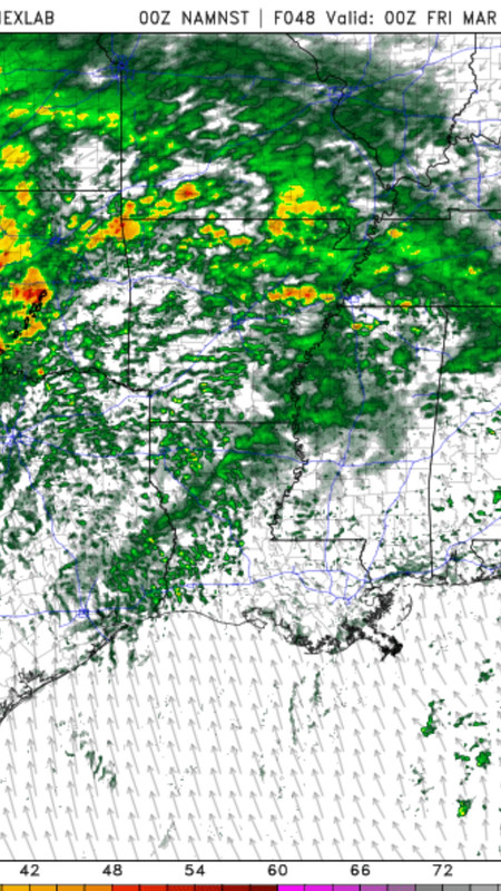
The NAM has ongoing rain/storms in the afternoon/evening. At 6PM:
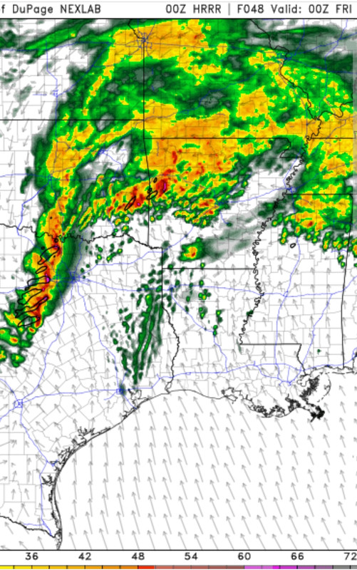
HRRR at 6PM:
The messiness of the NAM would definitely be preferred, both to limit daytime heating and to maybe crowd out any cells that try to form. The NAM has continued it's cold bias with it under doing temps by 7-8 degrees. HRRR gets temps to near 80°, where NAM keeps them in the lower 70s.
The concern, though, is that the HRRR is now showing an uncapped environment ahead of the main line and maybe a bit more pre-frontal activity. That is not what we want to see.
HRRR PDS sounding from east of Shreveport at 6pm:
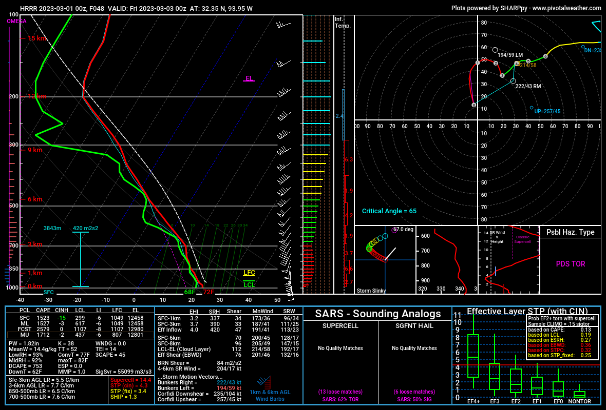
The cap is gone, the hodograph looks violent, and that's a whole lot of streamwise vorticity. Not ideal, at all.
The NAM has ongoing rain/storms in the afternoon/evening. At 6PM:
HRRR at 6PM:
The messiness of the NAM would definitely be preferred, both to limit daytime heating and to maybe crowd out any cells that try to form. The NAM has continued it's cold bias with it under doing temps by 7-8 degrees. HRRR gets temps to near 80°, where NAM keeps them in the lower 70s.
The concern, though, is that the HRRR is now showing an uncapped environment ahead of the main line and maybe a bit more pre-frontal activity. That is not what we want to see.
HRRR PDS sounding from east of Shreveport at 6pm:
The cap is gone, the hodograph looks violent, and that's a whole lot of streamwise vorticity. Not ideal, at all.
This post was edited on 2/28/23 at 9:12 pm
 2
2


Posted on 2/28/23 at 9:38 pm to LegendInMyMind
It's going to be a long night Thursday if the squall line looks like that already in DFW.

Posted on 2/28/23 at 10:01 pm to LegendInMyMind
I now understand how people view my posts about airline flights.
I was supposed to drive to north Dallas Thursday from Houston, arriving around 1600-1700, may re-think.
I was supposed to drive to north Dallas Thursday from Houston, arriving around 1600-1700, may re-think.
This post was edited on 2/28/23 at 10:07 pm

 Page 1 of 1


Popular
Back to top