- My Forums
- Tiger Rant
- LSU Recruiting
- SEC Rant
- Saints Talk
- Pelicans Talk
- More Sports Board
- Coaching Changes
- Fantasy Sports
- Golf Board
- Soccer Board
- O-T Lounge
- Tech Board
- Home/Garden Board
- Outdoor Board
- Health/Fitness Board
- Movie/TV Board
- Book Board
- Music Board
- Political Talk
- Money Talk
- Fark Board
- Gaming Board
- Travel Board
- Food/Drink Board
- Ticket Exchange
- TD Help Board
Customize My Forums- View All Forums
- Show Left Links
- Topic Sort Options
- Trending Topics
- Recent Topics
- Active Topics
Started By
Message
 1
1

Posted on 6/18/21 at 1:32 pm to SlidellCajun
quote:
it lessens the odds for another direct hit later in the season since it wouldn’t be fair
quote:
fair
Uh huh. I contemplated the word “fair” while evacuating for the second time from a major hurricane last year.
Good luck with that optimism about odds
Posted on 6/18/21 at 1:32 pm to A Smoke Break


Posted on 6/18/21 at 2:05 pm to Large Farva
quote:
CIRA
@CIRA_CSU
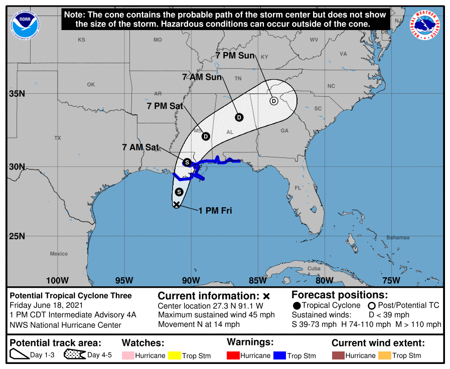
This morning's view of Potential Tropical Cyclone Three.
Posted on 6/18/21 at 2:58 pm to rds dc
This thing is landing more eastward than what these weather geeks are predicting. So obvious.
Posted on 6/18/21 at 3:03 pm to Roll Tide Ravens
I don't make fun of hurricanes. I make fun of pussies

Posted on 6/18/21 at 3:03 pm to tigerbutt
Weak storms tend to go more east. Except when they don’t, then they go more west. Strong storms tend to be pulled further north or East unless they go more west.
Posted on 6/18/21 at 3:09 pm to Midtiger farm
Louisiana set a record for how long a state was in the warning cones will be it be a new record this year? 

Posted on 6/18/21 at 3:15 pm to tigerbutt
quote:
This thing is landing more eastward than what these weather geeks are predicting. So obvious.
Convection =/= Center of Circulation with these shite storms
Posted on 6/18/21 at 3:17 pm to tigerbutt
quote:
This thing is landing more eastward than what these weather geeks are predicting. So obvious.
I haven't seen anyone make a "prediction".

Posted on 6/18/21 at 3:18 pm to The Boat
Chance this thing doesn't even make it to a Tropical Storm?
This post was edited on 6/18/21 at 3:26 pm
Posted on 6/18/21 at 3:19 pm to LaBR4
Posted on 6/18/21 at 3:20 pm to Bobby OG Johnson
quote:
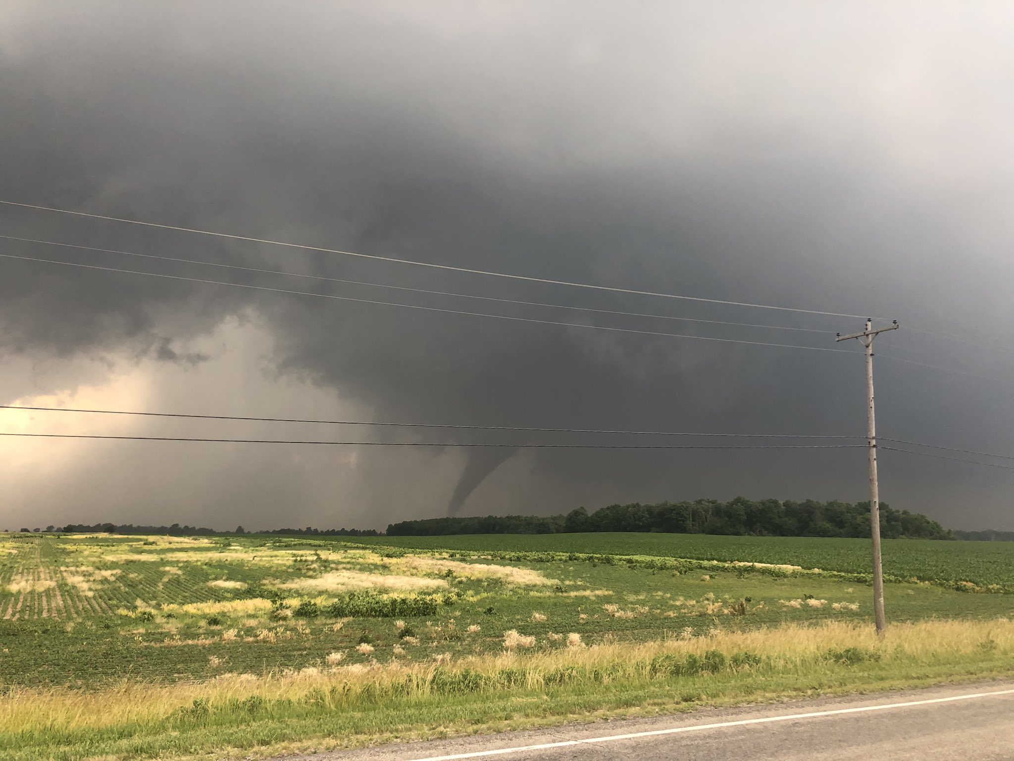
Harold
@LifeOfRold
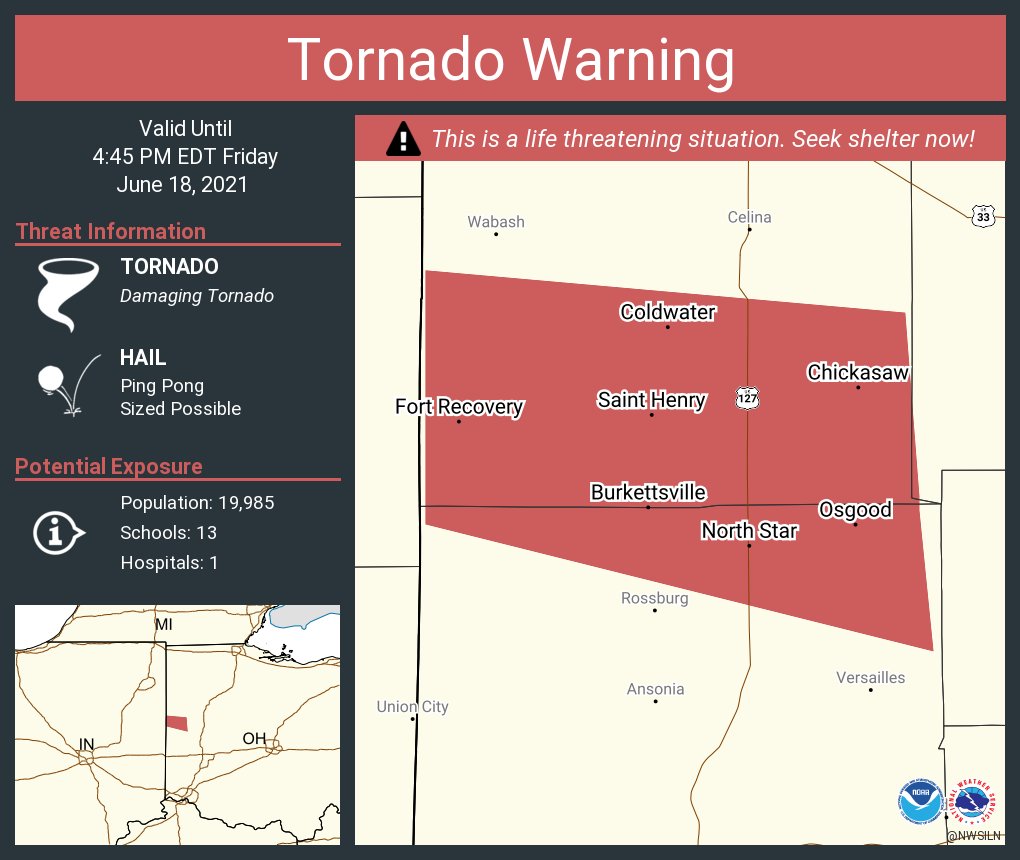
Tornado on ground Jay County, IN #INwx #OHwx
@NWSILN
Posted on 6/18/21 at 3:22 pm to tigerbutt
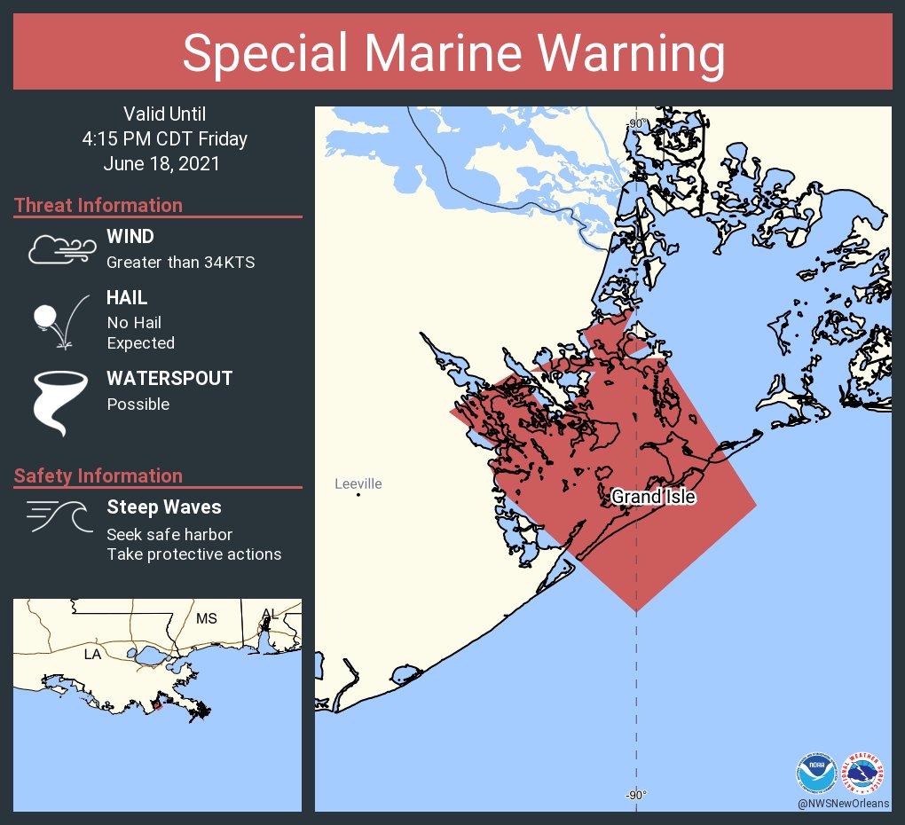
There is a mid-level 'center' over Grand Isle right now with heavy rain bands. The low level center is still around 28N 91W well south of Terrebonne / St. Mary coast.
Posted on 6/18/21 at 3:22 pm to Bobby OG Johnson
Posted on 6/18/21 at 3:26 pm to Bobby OG Johnson
nice find OG, helluva pic
Posted on 6/18/21 at 3:27 pm to Bobby OG Johnson
Yep. IN and OH have a chance for a rough evening. Not as bad as it could have been, but it still could be bad, and a potential overnight risk.
Posted on 6/18/21 at 3:30 pm to Bobby OG Johnson
quote:
James Spann
@spann
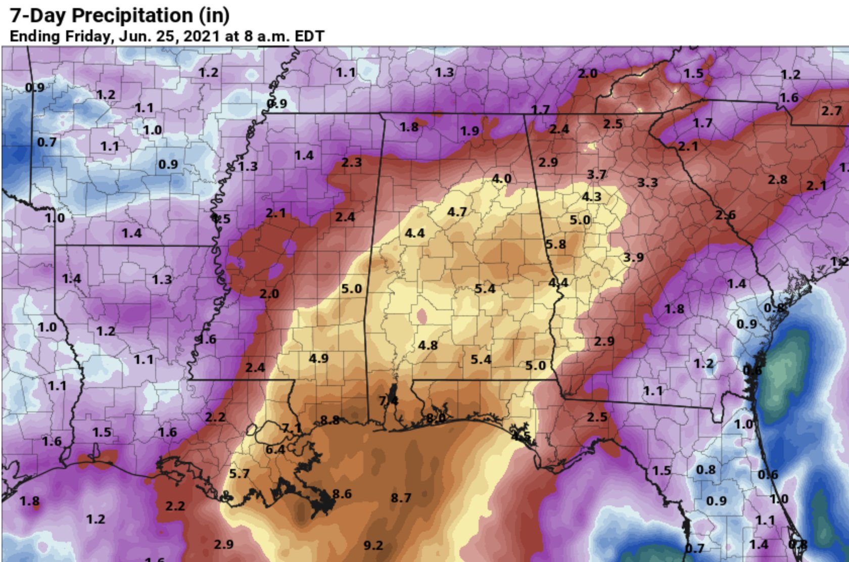
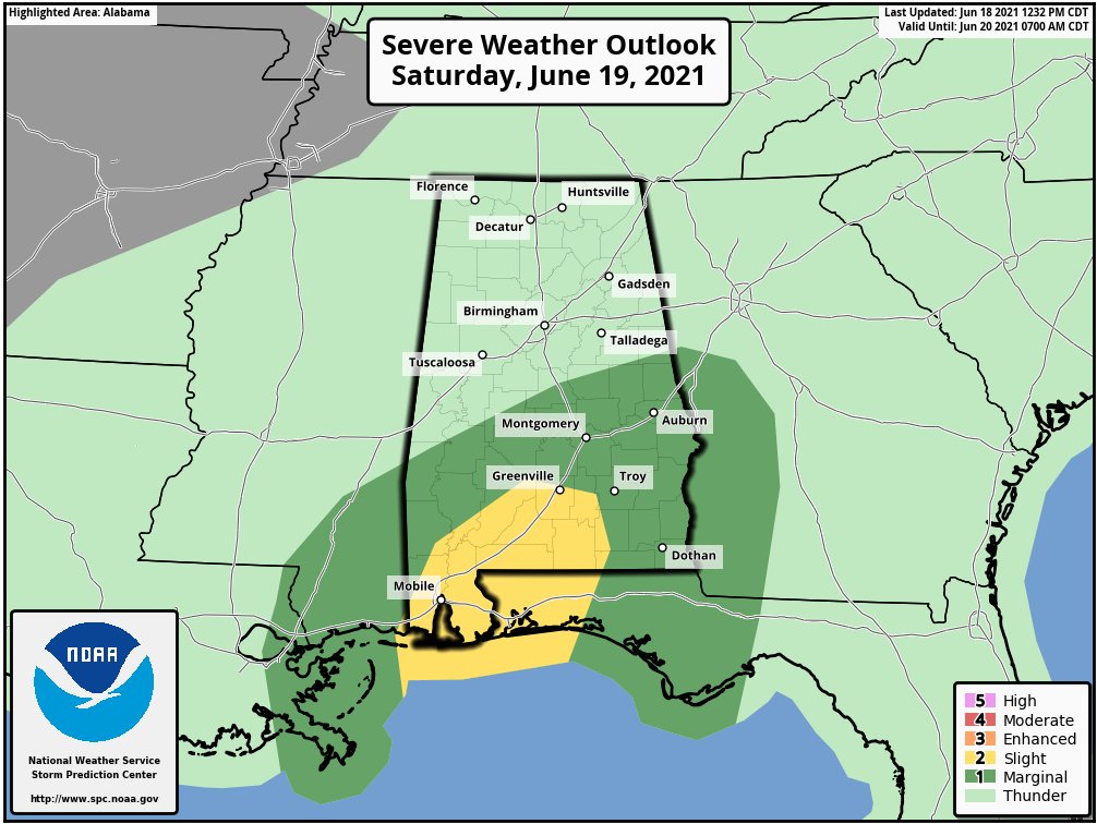
Tropical rain near the coast will spread northward across Alabama tonight and tomorrow. A flash flood watch is in effect areas along and south of I-20. A few isolated, brief tornadoes are possible over the southern half of the state tomorrow.
Posted on 6/18/21 at 3:31 pm to NorthEndZone
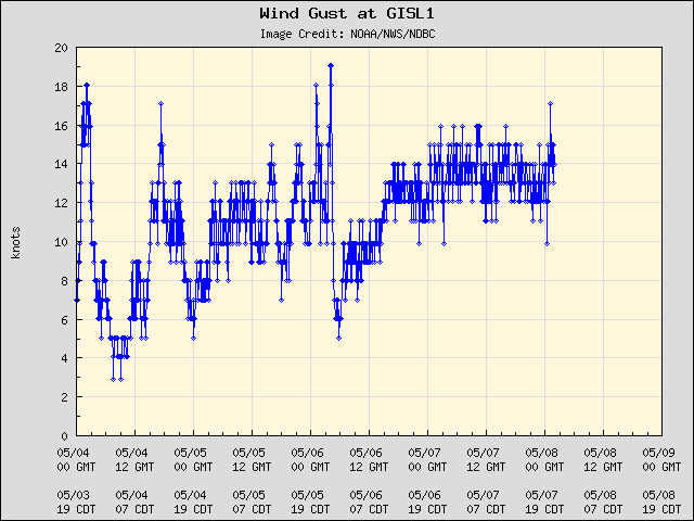
Grand Isle with a 42 knot (48 mph) gust in that strong rain band.
Posted on 6/18/21 at 3:31 pm to rds dc
BR is freaking out. Bumper to bumper traffic at 3:00

 Page 56 of 72

Popular
Back to top