- My Forums
- Tiger Rant
- LSU Recruiting
- SEC Rant
- Saints Talk
- Pelicans Talk
- More Sports Board
- Coaching Changes
- Fantasy Sports
- Golf Board
- Soccer Board
- O-T Lounge
- Tech Board
- Home/Garden Board
- Outdoor Board
- Health/Fitness Board
- Movie/TV Board
- Book Board
- Music Board
- Political Talk
- Money Talk
- Fark Board
- Gaming Board
- Travel Board
- Food/Drink Board
- Ticket Exchange
- TD Help Board
Customize My Forums- View All Forums
- Show Left Links
- Topic Sort Options
- Trending Topics
- Recent Topics
- Active Topics
Started By
Message

 0
0

Posted on 8/31/24 at 12:43 pm to Duke
quote:
Better to watch the steering develop and then figure things out in more detail when we get a defined system.
That has pretty much been the theme this year.
Posted on 8/31/24 at 12:59 pm to LegendInMyMind
Dr. Levi Cowan
@TropicalTidbits
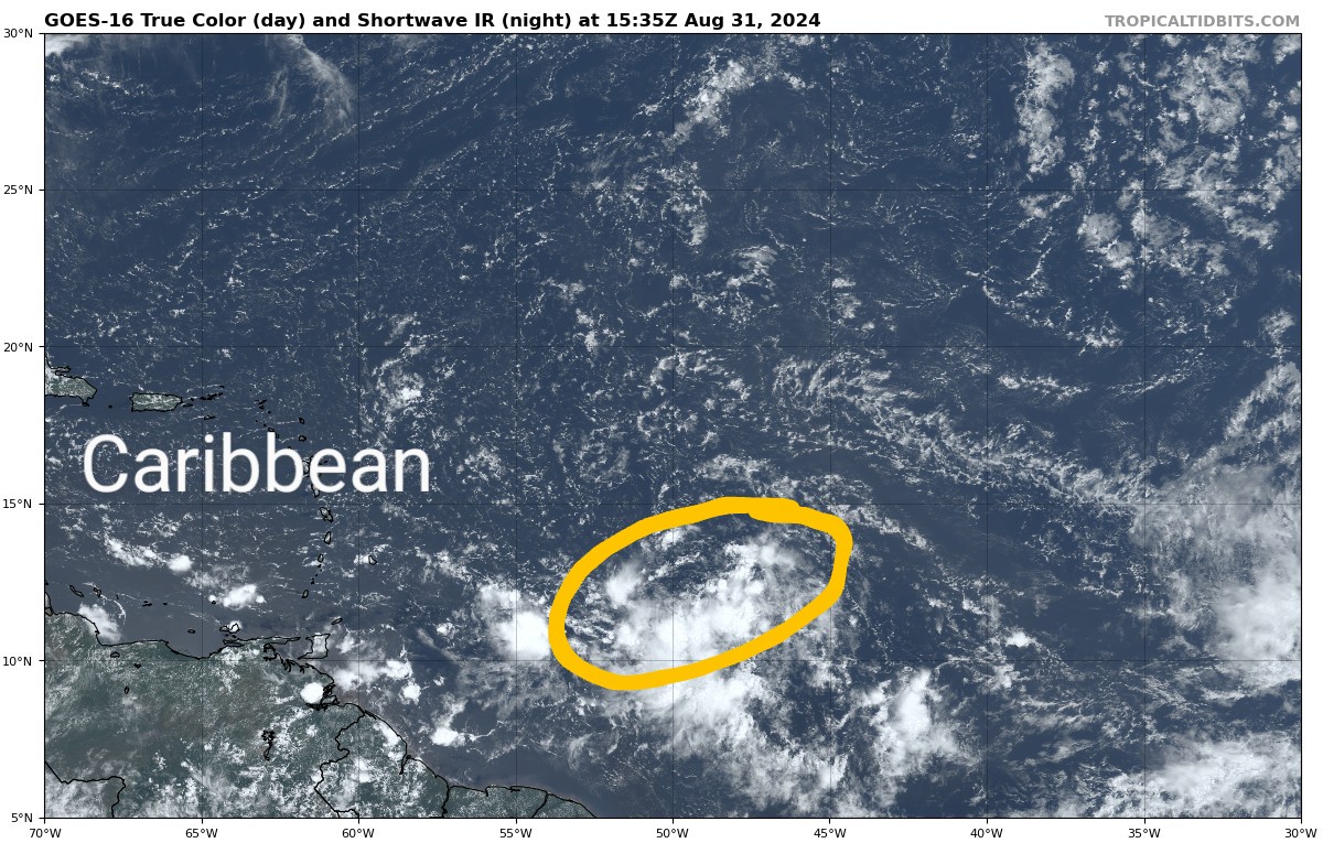
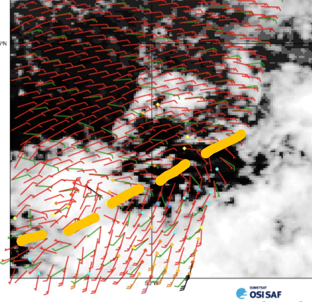
Watching a surface trough in the central Atlantic this weekend which has a chance to develop when it moves into the Caribbean next week. Born out of a weak monsoon trough, the disturbance is elongated SW to NE and does not have a well-defined circulation yet.
Environmental conditions should be generally favorable as the system moves westward, but models suggest that development is not guaranteed. Development will likely hinge simply on the amplitude of the disturbance as it leaves the monsoonal southwesterlies and enters the trade wind background flow of the Caribbean. If the vorticity perturbation is too weak, it could wash out into the background flow, but if it has enough "oomph" to couple with deep convection and self-sustain / amplify, we could see a tropical storm develop within the Caribbean next week. About one third of EPS and GEFS ensemble members currently show development, and
@NHC_Atlantic
currently gives 50% odds of this occurring.
Posted on 8/31/24 at 1:21 pm to lsuman25
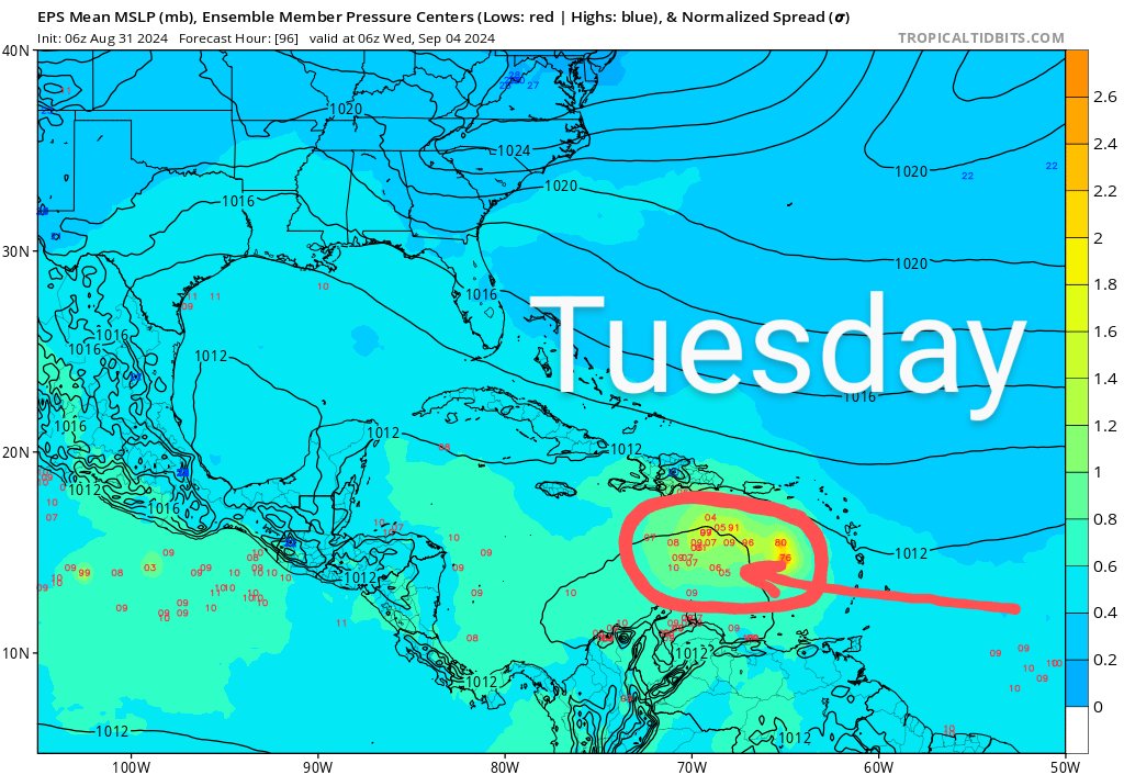
12z Euro with a preferred solution - Too weak to get picked up by the trough, and it slides across CA into the EPAC.
Posted on 8/31/24 at 1:24 pm to rds dc
That would be great. Probably just check back in here Tuesday and see where we are at then. Everyone enjoy the Labor Day holiday.

Posted on 8/31/24 at 2:10 pm to LSURoss

I saw this picture yesterday at 3:30 pm. Unconsciously I stood up, left work, went home and mowed grass. I don’t think I realized what I had done until after I finished.
Posted on 8/31/24 at 3:23 pm to lsuman25
We finally got some rain. 
Around 1" with more floating around. It was getting really dry.
Around 1" with more floating around. It was getting really dry.
Posted on 8/31/24 at 4:25 pm to Suntiger
Dropped it back to 40% and the wave behind it at 0%
I’m enjoying the fact the experts called for a awful season and it’s been a complete dud
I’m enjoying the fact the experts called for a awful season and it’s been a complete dud
Posted on 8/31/24 at 4:49 pm to deltaland
quote:
I’m enjoying the fact the experts called for a awful season and it’s been a complete dud
You shouldn’t be saying that part out loud.
We may just have to send you with that Bama fool that started talking about the season waking up earlier this month.
This post was edited on 8/31/24 at 4:50 pm
Posted on 8/31/24 at 5:08 pm to LegendInMyMind
not enough here.
Posted on 8/31/24 at 5:16 pm to rds dc
It seems to me based on NHC dropping development chances and many models getting less and less bullish it seems to me that this group of clouds has a very limited future. In fact it seems that this whole season just may not be nearly as bad as all the ‘experts’ thought.
Posted on 8/31/24 at 5:23 pm to otowntiger
And right on que the 18z GFS has a strengthening system heading towards the tip of Cuba. These models have no idea and keep going back and forth. They’ll keep doing this for next few days. We can’t right it off just yet
This post was edited on 8/31/24 at 5:25 pm
Posted on 8/31/24 at 5:43 pm to SWLA92
quote:
And right on que the 18z GFS has a strengthening system heading towards the tip of Cuba. These models have no idea and keep going back and forth. They’ll keep doing this for next few days. We can’t right it off just yet
Trying to make a run at Cat 5
Posted on 8/31/24 at 5:45 pm to rds dc
Just your normal Cat 4 borderline Cat 5 into Florabama
Posted on 8/31/24 at 5:47 pm to rds dc
SO what will happen they will up 7 day back to 50% then 00Z models go back to weak lol
Posted on 8/31/24 at 5:47 pm to SWLA92
This was near Florence, AL earlier today as the storms started to pop up and float around.
Loading Twitter/X Embed...
If tweet fails to load, click here.Posted on 8/31/24 at 6:03 pm to lsuman25
quote:
SO what will happen they will up 7 day back to 50% then 00Z models go back to weak lol
They probably won't do anything based on the 18z cycle. There would have to be a decent uptick on the 00z ensembles for them to bump it back to 50%.
Posted on 8/31/24 at 6:06 pm to rds dc
Oh I know just having fun with it. Seemed eveytime they up'ed it the models trended downward both times. 
Posted on 8/31/24 at 6:58 pm to LegendInMyMind
It’s rained here every day since Monday. It can stop now.
Posted on 8/31/24 at 8:32 pm to tiger91
Maybe we need to go back to the days of 3 day cones and not having everyone have access to a 300 hr forecast model.
Because this long range stuff is garbage when it comes to unformed storms.
Because this long range stuff is garbage when it comes to unformed storms.

 Page 12 of 492

Popular
Back to top