- My Forums
- Tiger Rant
- LSU Recruiting
- SEC Rant
- Saints Talk
- Pelicans Talk
- More Sports Board
- Fantasy Sports
- Golf Board
- Soccer Board
- O-T Lounge
- Tech Board
- Home/Garden Board
- Outdoor Board
- Health/Fitness Board
- Movie/TV Board
- Book Board
- Music Board
- Political Talk
- Money Talk
- Fark Board
- Gaming Board
- Travel Board
- Food/Drink Board
- Ticket Exchange
- TD Help Board
Customize My Forums- View All Forums
- Show Left Links
- Topic Sort Options
- Trending Topics
- Recent Topics
- Active Topics
Started By
Message
re: Central & Southern U.S. Severe Weather Continues: 4/27/2024 - 4/29/2024
Posted on 4/27/24 at 4:20 pm to Roll Tide Ravens

Posted on 4/27/24 at 4:20 pm to Roll Tide Ravens
I’ve got a couple of chaser streams from Seymour and it’s definitely rain wrapped right now.
 1
1


Posted on 4/27/24 at 4:21 pm to Bobby OG Johnson

Posted on 4/27/24 at 4:23 pm to Roll Tide Ravens
It is observed again without a CC drop. It has had ground confirmation multiple times, but never had a defined TDS.
Posted on 4/27/24 at 4:25 pm to Bobby OG Johnson
Seymour storm has more of an eastward path to it. It could be an issue for Wichita Falls in a little while if it holds together.
Posted on 4/27/24 at 4:26 pm to Roll Tide Ravens
What a radar signature on that storm. WOW
Posted on 4/27/24 at 4:27 pm to Roll Tide Ravens
quote:
I’ve got a couple of chaser streams from Seymour and it’s definitely rain wrapped right now.
Wind profiles are more akin to Dixie than the Plains today. Won't be a whole lot of picturesque storms.
Posted on 4/27/24 at 4:28 pm to razorbackfan4life

Posted on 4/27/24 at 4:30 pm to Roll Tide Ravens
I don't think it is a very steady state tornado. It has to be up and down or we'd see a TDS on radar. The velocity presentation kind of backs up that idea, too.
Posted on 4/27/24 at 4:30 pm to LegendInMyMind
quote:
Wind profiles are more akin to Dixie than the Plains today. Won't be a whole lot of picturesque storms.
Yep, makes sense. The one west of El Reno seems to have a BWER on it, so it’s rain wrapped, too.
Posted on 4/27/24 at 4:31 pm to LegendInMyMind
quote:
don't think it is a very steady state tornado. It has to be up and down or we'd see a TDS on radar. The velocity presentation kind of backs up that idea, too.
Seems like it keeps wrapping up really tight and occluding. May be getting so tight that it’s cutting itself off.
Posted on 4/27/24 at 4:34 pm to Roll Tide Ravens
See how on Reflectivity the rain is being wrapped back around the forward flank of the storm(s)? That's more of what we see down here instead of the really good venting that storms out on the Plains usually get. Makes it tough on chasers as you have to be close and almost tucked into the inflow notch region to get anything close to a clear look.
This post was edited on 4/27/24 at 4:35 pm
Posted on 4/27/24 at 4:43 pm to LegendInMyMind
Tornado Warning west of OK city. Located 5 miles nw of Calmut moving ne at 35 mph. This storm is producing golf ball size hail. Seek shelter immediately

Posted on 4/27/24 at 4:44 pm to LegendInMyMind
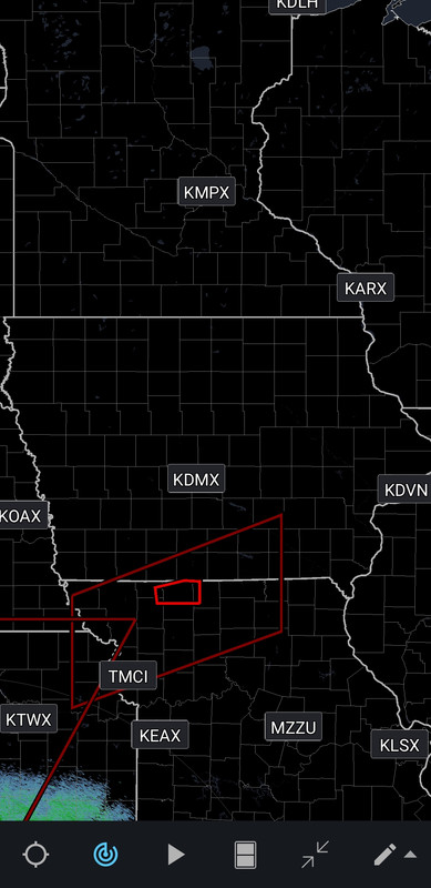
Man, Iowa really did just mail it in on laying out their counties, didn't they?

Posted on 4/27/24 at 4:45 pm to OU Guy
I keep looking at the radar and this storm looks massive and brutal
Posted on 4/27/24 at 4:48 pm to North Dallas Tiger

Posted on 4/27/24 at 4:54 pm to LegendInMyMind
quote:
Man, Iowa really did just mail it in on laying out their counties, didn't they?
You want your county to be square or square?
Posted on 4/27/24 at 5:04 pm to Roll Tide Ravens
Is this thing trying to line out?
Posted on 4/27/24 at 5:13 pm to Wishnitwas1998
quote:
Is this thing trying to line out?
It was always going to and become a wind/embedded tor threat into the night. CAMs have fired cells ahead of the line into the evening. More or less what was expected with the ceiling not really materializing to this point.
Posted on 4/27/24 at 5:17 pm to LegendInMyMind
There needs to be some type policy on chasers its getting so bad the pro chasers can’t get around to cover. So many rookie chasers making it dangerous for all, and delaying time sensitive reports


Posted on 4/27/24 at 5:19 pm to LegendInMyMind
quote:
It was always going to and become a wind/embedded tor threat into the night. CAMs have fired cells ahead of the line into the evening. More or less what was expected with the ceiling not really materializing to this point.
Gotya I didn't get to read much about this one beforehand

 Page 4 of 18

Popular
Back to top