- My Forums
- Tiger Rant
- LSU Recruiting
- SEC Rant
- Saints Talk
- Pelicans Talk
- More Sports Board
- Fantasy Sports
- Golf Board
- Soccer Board
- O-T Lounge
- Tech Board
- Home/Garden Board
- Outdoor Board
- Health/Fitness Board
- Movie/TV Board
- Book Board
- Music Board
- Political Talk
- Money Talk
- Fark Board
- Gaming Board
- Travel Board
- Food/Drink Board
- Ticket Exchange
- TD Help Board
Customize My Forums- View All Forums
- Show Left Links
- Topic Sort Options
- Trending Topics
- Recent Topics
- Active Topics
Started By
Message
Southeast Severe Weather: January 8-9, 2024
Posted on 1/6/24 at 6:02 am

Posted on 1/6/24 at 6:02 am
Tuesday, January 9th:


This post was edited on 1/9/24 at 5:35 am
 38
38

Posted on 1/6/24 at 6:28 am to Roll Tide Ravens
I ain’t complaining after that summer
Bring on La Nina
Bring on La Nina
Posted on 1/6/24 at 6:29 am to Roll Tide Ravens
Looks like the threat hasn’t increased from 2 days ago. What’s the main threat here? Squall or discrete cells?
All I know is Bassfield, Sumrall, Monticello, Columbia, and Laurel are always under a loaded gun time and time again on days like this.
All I know is Bassfield, Sumrall, Monticello, Columbia, and Laurel are always under a loaded gun time and time again on days like this.
This post was edited on 1/6/24 at 6:32 am

Posted on 1/6/24 at 7:05 am to Roll Tide Ravens
Let's hope this coastal system will remain tame.
Posted on 1/6/24 at 8:14 am to Roll Tide Ravens
Seeing some hints of winter weather event around 22nd. Any validity to that?

Posted on 1/6/24 at 3:59 pm to Roll Tide Ravens
Should we not wait until there is at least orange colored enhanced risk on the map before posting a freak out thread?

Posted on 1/6/24 at 4:26 pm to Roll Tide Ravens
I really missed the days when a thunderstorm was well, a thunderstorm and not some stupid fricking level 1-5 weather event.
Posted on 1/6/24 at 5:22 pm to Roll Tide Ravens
Great. Just in time for my kids first day back after the break. I’m sure they will cancel due to a leaf blowing too fast.
Posted on 1/6/24 at 5:37 pm to Roll Tide Ravens
The wind here in bham took a dead tree down in my yard last night. Ironically it fell up hill. If it had gone left it would have taken the power and cable lines to the house. Missed everything. Gotta cut it up tomorrow and work on another dead one before mondays weather.
Posted on 1/7/24 at 7:44 am to Roll Tide Ravens
OP updated.

Posted on 1/7/24 at 11:59 am to Roll Tide Ravens
Meh.
BIG WEATHER often hypes things up. Hopefully all goes well, but we'll see.
BIG WEATHER often hypes things up. Hopefully all goes well, but we'll see.
This post was edited on 1/7/24 at 7:41 pm

Posted on 1/7/24 at 12:20 pm to Roll Tide Ravens
Artic Air Blast 

Posted on 1/7/24 at 12:42 pm to Roll Tide Ravens
Not looking forward to tomorrow… could get rough.
Posted on 1/8/24 at 1:10 am to Roll Tide Ravens
Looks like the typical areas dodged this one
I'll take it
Hopefully it'll turn out not too bad for those in tbe risk areas
I'll take it
Hopefully it'll turn out not too bad for those in tbe risk areas
This post was edited on 1/8/24 at 1:24 am

Posted on 1/8/24 at 8:23 am to Roll Tide Ravens

This post was edited on 1/8/24 at 8:53 am
Posted on 1/8/24 at 8:48 am to Roll Tide Ravens
Explain it to me like I am not a meteorologist. What are the chances of us getting a good blow in central Mississippi?

Posted on 1/8/24 at 9:49 am to Roll Tide Ravens
Wind has picked up quickly here in DFW. Downrange I hope you folks are ready.
Posted on 1/8/24 at 11:23 am to Roll Tide Ravens
Is this going to affect my flight to Punta Cana?
Posted on 1/8/24 at 11:41 am to Roll Tide Ravens
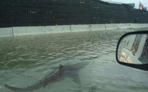
My cousin’s roommate’s uncle’s girlfriend’s ex-husband is in New Orleans today and he just sent me this. TIFWIW but I think it’s legit. Flooding must be bad.
Posted on 1/8/24 at 3:01 pm to Roll Tide Ravens
This is from SPC when they updated the convective outlook earlier. They mentioned the possibility of an upgrade to a moderate risk.
quote:
An extensive QLCS is still expected to develop this evening and move eastward along the Gulf Coast, with recent HRRR runs suggesting some potential for prefrontal supercell development. Any mature pre-frontal supercells could pose a strong tornado threat late tonight across parts of the central Gulf Coast, with damaging wind and line-embedded tornadoes also possible with the primary QLCS. A Moderate Risk upgrade remains possible with the 01Z update, depending on observational and short-term guidance trends regarding northward advance of the warm front and potential for mature prefrontal supercells overnight.

 Page 1 of 2

Popular
Back to top